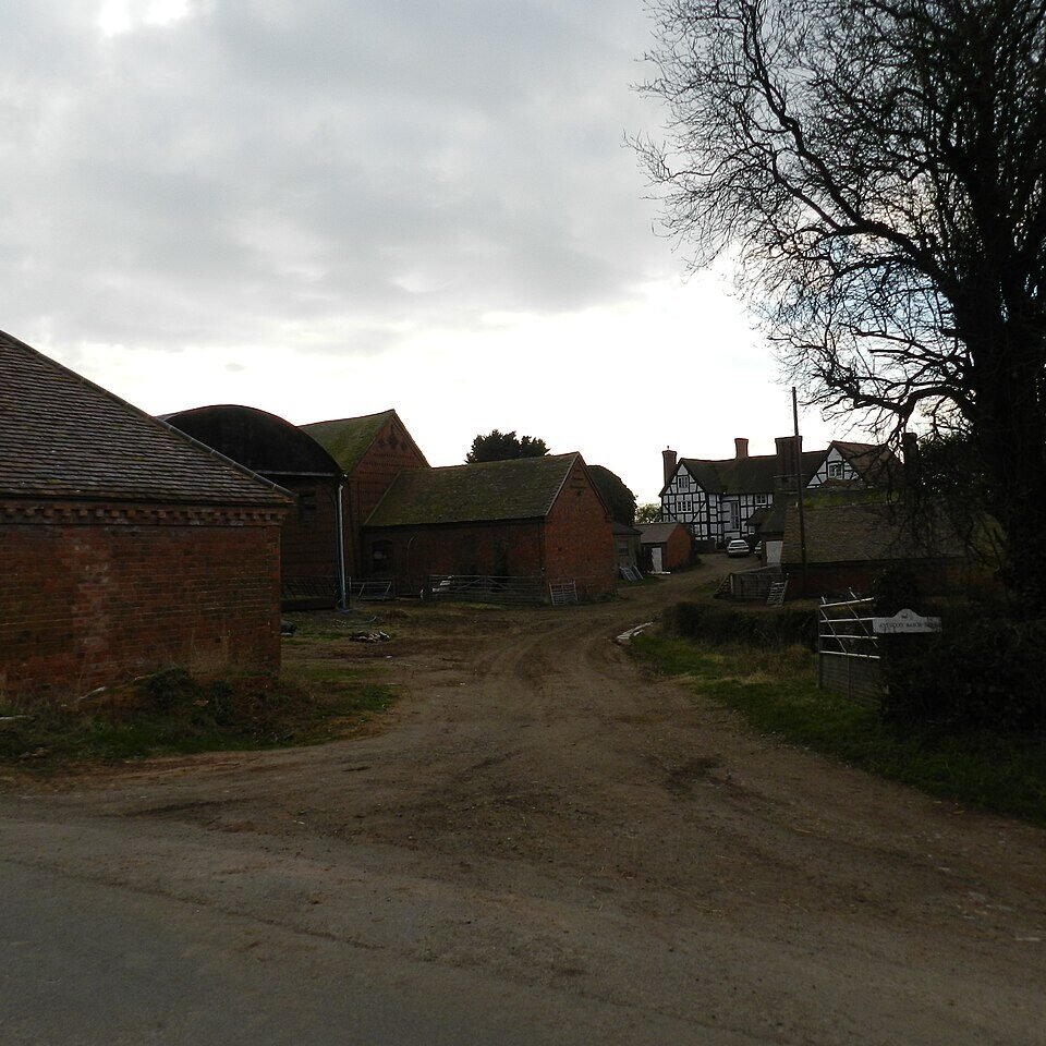



Historical names: Astwood Meynill (Manor) | Astwood Robert (Manor) | Astwood Savage (Manor)
Location: Dodderhill, Worcestershire
Places / associated places: Dodderhill, Worcestershire
Location & Extent
GPS Location & Recorded Land Areas
Representative GPS point: 52.2849, -2.1006
Identity: likely — The supplied primary name and historical names correspond to the medieval and later Astwood manorial complex in Dodderhill. Local historical research identifies Astwood Robert with the surviving Astwood Manor Farm, while Astwood Savage and Astwood Meynill are associated with Sagebury; these names reflect divisions and successive descriptions of the same Astwood territorial record rather than a different county or parish.
Representative point: 52.2849, -2.1006
Basis: documented_manor_house — Astwood Manor Farmhouse, Astwood Lane, is a surviving early seventeenth-century manor-house building listed by Historic England. Local historical research identifies it as the present Astwood Manor Farm associated with Astwood Robert, one of the recorded historical forms of Astwood Manor.
Point confidence: high
Boundary status: representative_point_only
Boundary period: Medieval to early nineteenth century
Boundary confidence: low
Boundary basis: The available evidence establishes a broad historical extent but does not provide a sufficiently precise manor map or parcel-by-parcel boundary for a defensible polygon. The Astwood estate is described as extending from Dodderhill Common and the boundary with Hanbury parish through Astwood, north-westward to Sagebury, Hobden and Moors, with a probable western or north-western limit along the line of the old Roman road, now the A38. Because parts of the estate were repeatedly divided and the cited border is explicitly described as probable, no polygon has been injected.
Sources:
- Dodderhill Parish Survey Project: Astwood: https://www.dodderhillhistory.org.uk/dodderhill-parish-survey-project-historic-places-buildings-estates-and-areas-astwood.php.html — Identifies Astwood Robert with Astwood Manor Farm; identifies Astwood Savage and Astwood Meynill with Sagebury; states that the original centre of the latter manor was around Sagebury and describes the broader Astwood yield as extending from Dodderhill Common and the Hanbury boundary through Astwood to Sagebury, Hobden and Moors, probably bounded by the old Roman road/A38.
- Astwood Manor Farmhouse, Historic England listing entry: https://historicengland.org.uk/listing/the-list/list-entry/1288254 — Lists Astwood Manor Farmhouse, Dodderhill, at OS grid reference SO 93233 65201, and describes the surviving early seventeenth-century farmhouse with remains of a moat.
- Medieval Genealogy: Feet of Fines, CP 25/1/259/16: https://www.medievalgenealogy.org.uk/fines/abstracts/CP_25_1_259_16.shtml — Provides medieval documentary evidence for Astwood Savage in Dodderhill and its connection with Hugh de Meynill.
- Nigel Stanley, University of Nottingham thesis PDF: https://eprints.nottingham.ac.uk/78913/1/Stanley%2C%20Nigel%2C%2014303965%2C%20second.pdf — Places Astwood Manor Farm within the Dodderhill/Wychbold landscape and supplies contextual mapping of the surrounding historical sites.
- The National Archives Discovery: F275484: https://discovery.nationalarchives.gov.uk/details/c/F275484 — Registry authority record supplied for the exact manor record, ASTWOOD MANOR, reference GB/NNAF/M293547.
Warnings / uncertainty:
- The representative point is safe for injection as the documented Astwood Manor Farmhouse, but it should not be interpreted as the full historical extent of the manor.
- No historically defensible polygon was found in the accessible evidence; the broad estate description is insufficient to reconstruct a precise perimeter without a manor map, survey, rental map, enclosure material, or mapped archival plan.
- Astwood Robert and Astwood Savage/Meynill appear to represent historically distinct divisions or phases within the Astwood manorial complex, so the exact medieval territorial relationship should be treated cautiously.
About the Manor
A manor at Astwood in the parish of Dodderhill, Worcestershire, recorded under the historical designations Astwood Meynill, Astwood Robert, and Astwood Savage.
Records & References
Sources and references mentioning this manor/title which are not necessarily conveyances or transfers.
1 record found · showing 1–1.
1635-1635: suit roll, with other manors
Held by: Worcestershire Archive and Archaeology Service
Further information: NRA 7371 Pakington
Corrections / Challenges
Sign in to challenge or submit evidence against a recorded assertion.
JSON API
Machine-readable published manor data, including public images, mapped land areas, notes, rights, conveyances, relationships, records, source/document-library entries and public file links.
https://manorialregistry.com/index.php?rest_route=/mhr/v1/manor/astwood-manor-4Public API access is currently disabled. Authorised API clients must use a private X-MHR-API-Key; currently only administrator keys are enabled.
Private source files, pending edits, moderation/admin information, user API keys and non-public import identifiers are not returned.