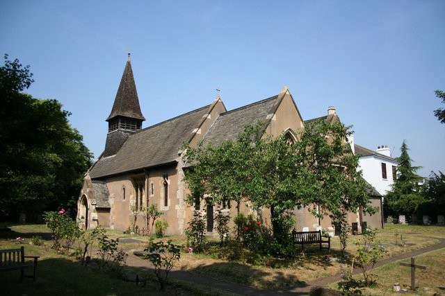



Location: Armthorpe, Yorkshire
Places / associated places: Armthorpe, Yorkshire
Location & Extent
GPS Location & Recorded Land Areas
Representative GPS point: 53.5365, -1.05965
Identity: confirmed — The TNA/MDR record F241206 is explicitly catalogued as Armthorpe Manor at Armthorpe, Yorkshire, and its associated Baxter court rolls, rentals, suit rolls and enfranchisement records are specifically described as records of the manor and customary court of Armthorpe. Historical sources independently identify Armthorpe as a manor held by Roche Abbey and later by the Crown and private lords.
Representative point: 53.53650, -1.05965
Basis: supported_manorial_centre — Approximate centre of the historic Armthorpe village/manorial core, near Church Street. Doncaster planning records identify a property named The Manor House on Church Street, while the historical evidence places the manor's settlement, church, open fields and woodland at Armthorpe. No securely documented medieval manor-house site was found, so this is not treated as a documented building coordinate.
Point confidence: medium
Boundary status: representative_point_only
Boundary period: Medieval to nineteenth century; extent not precisely datable from the located evidence
Boundary confidence: none
Boundary basis: The available evidence establishes a substantial manorial territory at Armthorpe, including open fields, woodland, meadows, inclosures, common pasture and named localities such as Gunhale, North-wood and South-wood. The seventeenth-century court material refers to the 'fields and territorie of Armthorpe' and names individual parcels and boundary features. Later accounts describe the manor as a substantial agricultural holding, and one nineteenth-century account gives the area of Armthorpe as approximately 3,810 acres. However, no complete manor map, rental map, enclosure award, tithe map or explicit perimeter description sufficient to reconstruct the historical manorial boundary was located. The modern civil-parish boundary cannot safely be substituted for the manor boundary.
Sources:
- The National Archives: Armthorpe Manor, TNA/MDR F241206: https://discovery.nationalarchives.gov.uk/details/c/F241206 — Primary registry record identifying the exact manor as Armthorpe Manor, Armthorpe, Yorkshire.
- Armthorpe Manorial Court Records: https://www.stableshistory.co.uk/court_records.htm — Transcribed extracts from the Baxter court material, including the 1649 phrase 'Fields and Territorie of Armthorpe' and descriptions of named fields, woods, roads and parcel boundaries.
- The History of Roche Abbey, volume on its possessions: https://upload.wikimedia.org/wikipedia/commons/7/7c/Yorkshire._The_history_of_Roche_abbey%2C_from_its_foundation_to_its_dissolution_%28IA_cu31924028012775%29.pdf — Historical account stating that Armthorpe was a major Roche Abbey possession, that its grange was given before 1186, that the abbot was lord of Armthorpe, and that the property passed to the Crown after the Dissolution.
- Doncaster Ancestor, Summer 2020: Armthorpe history: https://doncasterfhs.co.uk/wp-content/uploads/2022/09/dasummer2020.pdf — Local historical account describing the medieval grange and manor, later ownership, surrounding open fields and woodland, and the 3,810-acre nineteenth-century area of Armthorpe.
- Doncaster Unitary Development Plan: Population and Housing: https://doncaster.opus3.co.uk/ldf/documents/Doncaster%20UDP/Population%20and%20Housing — Council planning record identifying 'The Manor House, Church Street, Armthorpe', supporting the Church Street village-core representative point.
- DN3 3AD postcode geodata: https://www.getthedata.com/postcode/DN3-3AD — Open Postcode Geo coordinate for the Church Street/Manor House locality: latitude 53.536483, longitude -1.059645.
Warnings / uncertainty:
- The representative point is an evidence-based approximation of the historic manorial centre, not a confirmed surviving medieval manor-house location.
- No defensible complete historical manor boundary polygon was found.
- The 3,810-acre figure describes the nineteenth-century area of Armthorpe in the located account and should not automatically be treated as the exact medieval or early-modern manorial acreage.
- Armthorpe land was historically intermingled with or associated with the neighbouring Streetthorpe/Edenthorpe estate; this does not establish that the two manors shared one boundary.
About the Manor
A manor associated with Armthorpe, now in South Yorkshire and historically in the West Riding of Yorkshire.
Records & References
Sources and references mentioning this manor/title which are not necessarily conveyances or transfers.
8 records found · showing 1–8.
1851: deed and award of enfranchisement of copyhold land
Held by: The National Archives
1840-1900: file of evidence rel to enfranchisement of copyhold land
Held by: The National Archives
1825-1829: court roll
Held by: Doncaster Archives
Further information: NRA 511
1730-1896: steward's court papers, minutes, presentments and surrenders (4 bdls)
Held by: Doncaster Archives
Further information: NRA 511
1715-1726: suit rolls
Held by: Doncaster Archives
Further information: NRA 511
1711-1738: court rolls
Held by: Doncaster Archives
Further information: NRA 511
1700- 1700: rental
Held by: Doncaster Archives
Further information: NRA 511
1648-1706: court rolls
Held by: Doncaster Archives
Further information: NRA 511
Corrections / Challenges
Sign in to challenge or submit evidence against a recorded assertion.
JSON API
Machine-readable published manor data, including public images, mapped land areas, notes, rights, conveyances, relationships, records, source/document-library entries and public file links.
https://manorialregistry.com/index.php?rest_route=/mhr/v1/manor/armthorpe-manorPublic API access is currently disabled. Authorised API clients must use a private X-MHR-API-Key; currently only administrator keys are enabled.
Private source files, pending edits, moderation/admin information, user API keys and non-public import identifiers are not returned.