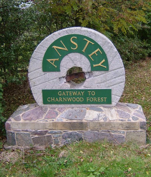



Historical names: Ansty (Manor)
Location: Anstey, Leicestershire
Places / associated places: Anstey, Leicestershire
Location & Extent
GPS Location & Recorded Land Areas
Representative GPS point: 52.673339, -1.196916
Identity: likely — The registry record and supplied archive leads identify the Leicestershire manor of Anstey/Ansty. Historical evidence shows that Anstey contained more than one medieval landholding, including Leicester Abbey and Ulverscroft-related interests; the surviving manor-centre evidence most closely associated with the recorded Anstey Manor is Manor Farm at the western end of Anstey Green, historically within the Newtown Linford parish area and later associated with the Grey/Bradgate estate. The exact legal distinction between the several historical manorial holdings cannot be confirmed from the accessible catalogue descriptions alone.
Representative point: 52.673339, -1.196916
Basis: supported_manorial_centre — Manor Farm, 20 The Green, Anstey, is identified by historical research as the most likely site of the caput or successor farm of a principal medieval Anstey estate. The site is also recorded locally as Manor Farm and is associated with the former Ulverscroft/Bradgate landholding.
Point confidence: medium
Boundary status: representative_point_only
Boundary period:
Boundary confidence: none
Boundary basis: The available evidence establishes the historical location of the manor centre and indicates that Anstey had multiple overlapping or distinct medieval manorial holdings, but no authoritative source located in this research supplies a defensible perimeter for this exact registry manor. The modern parish, settlement, enclosure area or Bradgate estate cannot safely be substituted for the historical manorial extent.
Sources:
- The National Archives: ANSTEY MANOR, TNA/MDR record F284905: https://discovery.nationalarchives.gov.uk/details/c/F284905 — Registry record for the supplied manor identity and authority reference GB/NNAF/M308935.
- The National Archives: Court roll, 1547, SC 2/183/35: https://discovery.nationalarchives.gov.uk/details/r/N17008774 — Archive lead supplied for the manor; confirms the existence of a mid-sixteenth-century Anstey manorial court record, although the accessible catalogue page does not expose a boundary or detailed place description.
- Leicestershire, Leicester and Rutland Record Office: Suit roll, 1735, DE5742/52: https://discovery.nationalarchives.gov.uk/details/r/N17009937 — Archive lead supplied for the manor; potentially relevant to the later Grey/Bradgate estate connection, but the accessible catalogue page does not provide a mapped extent.
- Between Two Forests: The Social and Topographic Evolution of Medieval Anstey: https://scispace.com/pdf/between-two-forests-the-social-and-topographic-evolution-of-1rwic0i7fq.pdf — Scholarly study states that the 1762 enclosure map shows Manor Farm at the western end of Anstey Green and identifies it as the most likely site of the caput of the Danvers fee and the centre of that estate's successor farm; it also distinguishes the Leicester Abbey holding from other Anstey landholdings.
- Anstey Local History Society, Early Anstey Trail: https://ansteyhistory.com/heritage-trails/early-anstey-trail/ — Local historical account records the two settlement nuclei, the historical importance of Anstey Green, and the association of Manor Farm with former monastic and later Grey/Bradgate land.
- Anstey Local History Society, Industry Trail: https://ansteyhistory.com/heritage-trails/industry-trail/ — Identifies Manor Farm at the top end of The Green and records its former association with Ulverscroft Abbey and the 1762 enclosure allotment to the Earl of Stamford/ Grey family.
- LE7 7FT postcode map and property data: https://www.doogal.co.uk/ShowMap?postcode=LE7+7FT — Provides the mapped location and coordinates for Manor Farm, 20 The Green, Anstey: 52.673339, -1.196916.
Warnings / uncertainty:
- Anstey contained more than one historically distinct manorial or estate holding, so the exact legal extent of the registry manor remains uncertain.
- The representative point is based on a historically supported manor-centre/site identification, not on a surviving surveyed manor boundary.
- No polygon is returned because the available evidence does not document or reconstruct the perimeter of this exact manor without substantial speculation.
About the Manor
A manor associated with Anstey in the historic parish of Anstey, Leicestershire.
Records & References
Sources and references mentioning this manor/title which are not necessarily conveyances or transfers.
2 records found · showing 1–2.
1735-1735: suit roll
Held by: Leicestershire, Leicester and Rutland, Record Office for
Further information: NRA 43474
1547-1547: court roll
Held by: The National Archives
Corrections / Challenges
Sign in to challenge or submit evidence against a recorded assertion.
JSON API
Machine-readable published manor data, including public images, mapped land areas, notes, rights, conveyances, relationships, records, source/document-library entries and public file links.
https://manorialregistry.com/index.php?rest_route=/mhr/v1/manor/anstey-manor-2Public API access is currently disabled. Authorised API clients must use a private X-MHR-API-Key; currently only administrator keys are enabled.
Private source files, pending edits, moderation/admin information, user API keys and non-public import identifiers are not returned.