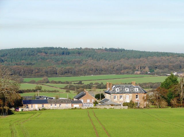



Location: Carisbrooke, Isle of Wight
Places / associated places: Carisbrooke, Isle of Wight
Location & Extent
GPS Location & Recorded Land Areas
Representative GPS point: 50.6945, -1.3287
Identity: confirmed — The TNA/MDR record F236961 is explicitly for Alvington Manor in Carisbrooke, Isle of Wight. Independent historical sources place Alvington Manor in Carisbrooke and associate Carisbrooke Castle, Carisbrooke church and related land with the manor, distinguishing it from the unrelated Alvington manor in Gloucestershire.
Representative point: 50.6945, -1.3287
Basis: documented_manor_house — Alvington Farmhouse, now Alvington Manor Farm, is the documented historic house associated with the manor. Historic England lists the building at NGR SZ4751288528; the published conversion gives 50.6945, -1.3287.
Point confidence: high
Boundary status: representative_point_only
Boundary period: Medieval to early modern; precise period of the recorded 1558-1559 survey extent
Boundary confidence: none
Boundary basis: The available online evidence establishes the manor's location and identifies associated constituent sites, including Carisbrooke Castle, Carisbrooke church/priory and a mill, but does not provide a sufficiently legible manor map, mapped parcel schedule or explicit perimeter from which a defensible historical polygon can be reconstructed. The 1558-1559 survey JER/MISC/78 is a strong archival lead but its territorial content was not available online for boundary extraction.
Sources:
- The National Archives, Manorial Documents Register: Alvington Manor, F236961: https://discovery.nationalarchives.gov.uk/details/c/F236961 — Registry record identifying Alvington Manor in Carisbrooke, Isle of Wight, under authority/reference GB/NNAF/M167736.
- Isle of Wight Record Office survey, 1558-1559, JER/MISC/78: https://discovery.nationalarchives.gov.uk/details/r/N14373179 — Archival survey record supplied as the principal historical-land extent lead; the online catalogue does not expose a usable boundary map or parcel perimeter.
- Alvington Farmhouse, Historic England listing 1365222: https://historicengland.org.uk/listing/the-list/list-entry/1365222 — Documents the listed C18 Alvington Farmhouse at NGR SZ4751288528, providing the best precise surviving manor-house location.
- The Walled Kitchen Gardens of the Isle of Wight: Alvington: https://iowgardenstrust.co.uk/uploads/1/4/3/7/143782901/walled_20kitchen_20gardens_20of_20the_20iw-compressed.pdf — Identifies the C18 house at what is now Alvington Manor Farm and places it at SZ 4755 8860; historical maps show the house and its associated garden.
- The Isle of Wight Historic Landscape Characterisation, archaeological and historical discussion of Carisbrooke: https://eprints.bournemouth.ac.uk/20803/1/Vol_1_%28amended%29.pdf — Discusses Alvington Manor in Carisbrooke and reports that Carisbrooke church and castle lay within Alvington Manor, while cautioning against treating the parish as the manor boundary.
Warnings / uncertainty:
- No reliable online source located a complete, explicit polygon for the historical manorial land of Alvington Manor.
- Do not substitute the modern Carisbrooke/Newport administrative boundary, parish boundary, conservation-area boundary or the modern Alvington Manor Farm landholding for the manor extent.
- The representative point identifies the documented manor-house site at Alvington Farmhouse/Alvington Manor Farm, not the geometric centre of the full medieval or early-modern manor.
About the Manor
A manor associated with Carisbrooke on the Isle of Wight.
Records & References
Sources and references mentioning this manor/title which are not necessarily conveyances or transfers.
1 record found · showing 1–1.
1558-1559: survey
Held by: Isle of Wight Record Office
Corrections / Challenges
Sign in to challenge or submit evidence against a recorded assertion.
JSON API
Machine-readable published manor data, including public images, mapped land areas, notes, rights, conveyances, relationships, records, source/document-library entries and public file links.
https://manorialregistry.com/index.php?rest_route=/mhr/v1/manor/alvington-manorPublic API access is currently disabled. Authorised API clients must use a private X-MHR-API-Key; currently only administrator keys are enabled.
Private source files, pending edits, moderation/admin information, user API keys and non-public import identifiers are not returned.