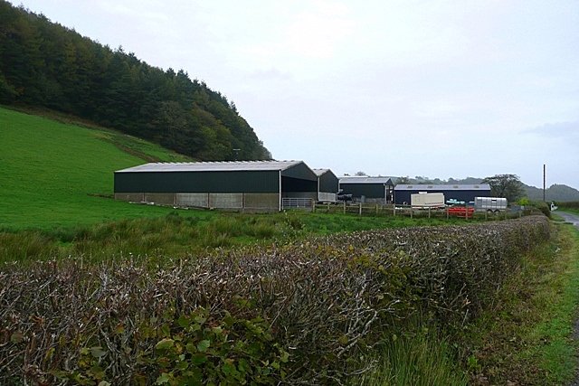



Location: Carmarthenshire
Places / associated places: Carmarthenshire
Location & Extent
GPS Location & Recorded Land Areas
Representative GPS point: 51.86928, -4.07483
Identity: confirmed — The exact primary name is corroborated by Carmarthenshire place-name scholarship, which records Allt-y-gaer as a manor and identifies earlier forms Athelgair, Athelgar, Altegar and Althegar. The historical location is specifically associated with Llangathen in Carmarthenshire, not with similarly named places elsewhere in Wales. The Heneb historic-landscape record identifies a medieval lordship of Allt-y-gaer centred on Cwm Agol south of Grongaer Hill, while archaeological gazetteer evidence identifies the surviving Allt y Gaer historic-home/fortified-dwelling site.
Representative point: 51.86928, -4.07483
Basis: documented_manor_house — Documented Allt y Gaer historic home and probable medieval/post-medieval fortified dwelling at Allt y Gaer Farm, Llangathen; OS grid reference SN57202095.
Point confidence: medium
Boundary status: representative_point_only
Boundary period: Medieval lordship/manor; precise perimeter period not established
Boundary confidence: none
Boundary basis: The available evidence locates the lordship at Cwm Agol south of Grongaer Hill and places it within the wider Llangathen historic landscape, but does not supply a manor-specific boundary map, parcel schedule, rental map, or sufficiently explicit perimeter description. The Llangathen historic-landscape character-area boundary cannot be substituted for the historical manorial boundary.
Sources:
- The National Archives Discovery record F237759: https://discovery.nationalarchives.gov.uk/details/c/F237759 — Registry record supplied for Allt-y-Gaer Manor; used as the target record identity.
- Heneb Historic Environment Record: Llangathen Historic Landscape Character Area: https://archwilio.org.uk/her/chi3/report/page.php?watprn=DAT40224 — States that the medieval Lordship of Allt-y-gaer was centred on Cwm Agol south of Grongaer Hill, and records a medieval-post-medieval fortified dwelling at Allt-y-gaer. It also describes the surrounding Llangathen landscape but does not define a manor boundary.
- The Gatehouse Record: Allt y gaer, Llangathen: https://www.gatehouse-gazetteer.info/Welshsites/183.html — Identifies Allt y Gaer in Llangathen, Carmarthenshire, records OS grid reference SN57202095, and gives coordinates 51.86928, -4.07483. It describes the site as a historic home with medieval origins and a probable fortified dwelling.
- Place-Names of Carmarthenshire: Abbreviations and Bibliography: https://www.cymdeithasenwaulleoedd.cymru/wp-content/uploads/2022/10/PNCarmRefs.pdf — Records the historical forms Athelgair, Athelgar, Altegar and Althegar; identifies Allt-y-gaer or Kethinog as a queen's manor in 1596 and Alltigaer as a manor c.1597; links the name to the Llangathen historical context.
- Coflein/Cadw Holy Wells project report: https://coflein.gov.uk/media/85/953/dat21_04.pdf — Places Ffynnon Gathen in the vicinity of Allt y Gaer Farm, southwest of Llangathen, providing additional local geographic corroboration for the manor-house/farm location.
Warnings / uncertainty:
- No defensible manor-specific territorial polygon was found in the available sources.
- The Llangathen historic-landscape character area, parish, community, commote, hundred, or modern Carmarthenshire boundary must not be used as a substitute for the manor's historical extent.
- The representative coordinate identifies the documented Allt y Gaer manor-house/fortified-dwelling site and should not be interpreted as the centre of the full medieval lordship.
Corrections / Challenges
Sign in to challenge or submit evidence against a recorded assertion.
JSON API
Machine-readable published manor data, including public images, mapped land areas, notes, rights, conveyances, relationships, records, source/document-library entries and public file links.
https://manorialregistry.com/index.php?rest_route=/mhr/v1/manor/allt-y-gaer-manorPublic API access is currently disabled. Authorised API clients must use a private X-MHR-API-Key; currently only administrator keys are enabled.
Private source files, pending edits, moderation/admin information, user API keys and non-public import identifiers are not returned.