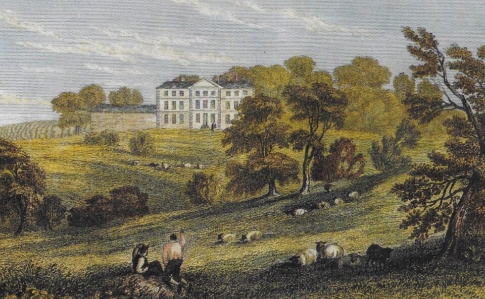



Location: Allesley, Warwickshire
Places / associated places: Allesley, Warwickshire
Listed in Domesday Book: Yes
Location & Extent
GPS Location & Recorded Land Areas
Representative GPS point: 52.41888, -1.5611
Identity: confirmed — The registry record, TNA/MDR reference F242159, authority GB/NNAF/M229069, associated place Allesley, and the supplied manorial records consistently identify the historic Manor of Allesley in Warwickshire. The archival sequence includes medieval extents, court rolls, rentals, surveys, a 1626 survey, and an 1817 description of the manor and parish boundaries. The record is distinct from similarly named places elsewhere because the associated place and archival descriptions specifically locate it at Allesley near Coventry.
Representative point: 52.41888, -1.56110
Basis: documented_manor_house — Allesley Hall occupies the established manorial and estate centre in Allesley Park. Heritage evidence links the medieval manorial complex to the park, records a later manor house there, and identifies the post-1660 hall as the successor focus of the Allesley manor. The coordinate is the mapped location of Allesley Hall and is preferable to a village-centre proxy.
Point confidence: high
Boundary status: representative_point_only
Boundary period: Not reconstructed; an 1817 boundary description is catalogued but its actual text or accompanying mapped perimeter was not available in the consulted online evidence.
Boundary confidence: none
Boundary basis: The evidence confirms the manor's historic centre and its association with Allesley Park, but does not provide enough accessible, explicit geographic information to distinguish the manorial land boundary from the parish boundary, medieval deer-park boundary, later private estate, or modern public park. The 1817 archive item is specifically described as a boundary document, but a catalogue description alone is insufficient for drawing a defensible polygon.
Sources:
- The National Archives Discovery: Allesley Manor, TNA/MDR record F242159: https://discovery.nationalarchives.gov.uk/details/c/F242159 — Registry record for the exact manor, associated with Allesley, Warwickshire.
- Birmingham Archives collection browser: Allesley manorial and estate records: https://calmview.birmingham.gov.uk/CalmView/TreeBrowse.aspx?field=RefNo&key=MS%203069%2F10%2F39&src=CalmView.Catalog — Catalogues Allesley court rolls, medieval and early-modern historical papers, the 1741 chief-rent roll, the 1817 description of the manor and parish boundaries, and 1828 and 1830 plans of Allesley Park.
- Historic England: Motte castle 150m SSW of Allesley Hall, NHLE 1005907: https://historicengland.org.uk/listing/the-list/list-entry/1005907 — Places the medieval Allesley Castle/manorial archaeological focus at SP 29906 80049 and describes the historic site within the landscape immediately south-west of Allesley Hall.
- Heritage Gateway: Allesley Castle / manorial complex, HER MCT118: https://www.heritagegateway.org.uk/Gateway/Results_Single.aspx?resourceID=1029&uid=MCT118 — States that the Manor House and home farm of the lords of the manor were sited within what later became Allesley Park; a 1387 survey recorded a manorial complex, chapel and dovecote, and the later hall probably occupied the successor manorial centre.
- Coventry City Council, A Vision for Allesley Park Walled Garden: https://edemocracy.coventry.gov.uk/documents/s19252/A%20Vision%20for%20Allesley%20Park%20Walled%20Garden%20Appendix%201.doc.pdf — Identifies Allesley Hall as the centre of the private estate of John Neale, Lord of the Manor of Allesley, and describes the hall, park, walled garden and wider farmland as components of the historic estate.
- Mapcarta: Allesley Hall: https://mapcarta.com/W190293226 — Provides the mapped coordinate used for the representative point: 52.41888, -1.56110.
Warnings / uncertainty:
- No defensible manorial boundary polygon has been returned.
- Allesley Park, the medieval deer park and the later private estate must not automatically be treated as identical to the legal or customary extent of the Manor of Allesley.
- The 1817 boundary description is a strong archival lead, but the online catalogue entry does not expose sufficient boundary detail for geographic reconstruction.
- The representative point denotes the documented successor manor-house site at Allesley Hall, not the geometric centre of all historical manorial lands.
About the Manor
Historic manor of Allesley in Warwickshire, recorded in Domesday Book in 1086.
Records & References
Sources and references mentioning this manor/title which are not necessarily conveyances or transfers.
43 records found · showing 1–8.
1865-1865: deeds and awards of enfrancisement of copyhold land
Held by: The National Archives
1840-1840: rental of chief rents (2 copies)
Held by: Warwickshire County Record Office
Further information: NRA 26324 Neale
1817-1817: description of boundaries
Held by: Shakespeare Birthplace Trust
Further information: NRA 21856 Leigh
1817-1817: description of boundaries
Held by: Oxford University: Queen's College Library
1779-1802: court rolls
Held by: Birmingham: Archives, Heritage and Photography Service
1777-1778: court rolls (2)
Held by: Warwickshire County Record Office
Further information: NRA 26324 Neale
1768-1768: pains and orders
Held by: Birmingham: Archives, Heritage and Photography Service
1768-1768: list of freeholders and tenants
Held by: Birmingham: Archives, Heritage and Photography Service
Corrections / Challenges
Sign in to challenge or submit evidence against a recorded assertion.
JSON API
Machine-readable published manor data, including public images, mapped land areas, notes, rights, conveyances, relationships, records, source/document-library entries and public file links.
https://manorialregistry.com/index.php?rest_route=/mhr/v1/manor/allesley-manorPublic API access is currently disabled. Authorised API clients must use a private X-MHR-API-Key; currently only administrator keys are enabled.
Private source files, pending edits, moderation/admin information, user API keys and non-public import identifiers are not returned.