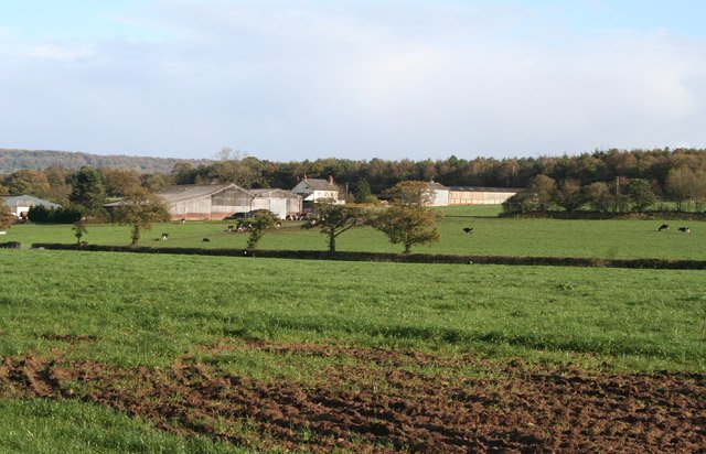



Location: Kentisbeare, Devon
Places / associated places: Kentisbeare, Devon
Location & Extent
GPS Location & Recorded Land Areas
Representative GPS point: 50.8522, -3.3486
Identity: confirmed — The registry name, Kentisbeare location, associated place, authority reference and TNA/MDR record consistently identify the manor at Aller in Kentisbeare, Devon. Historical evidence distinguishes this from Aller/Aller Peverell in Cullompton parish and from Aller in Abbotskerswell.
Representative point: 50.8522, -3.3486
Basis: supported_manorial_centre — Supported centre of the historic Aller holding at the Aller hamlet/farmstead cluster, interpolated between the documented late-medieval Green's Farmhouse (now Aller Restaurant) at ST0525106663 and early-sixteenth-century Maddock's Farmhouse at ST0507106785. Local historical evidence identifies Aller/Green's and Maddock's as the two later parts of the Aller manor.
Point confidence: medium
Boundary status: representative_point_only
Boundary period: Medieval to early modern; exact period-specific perimeter undetermined
Boundary confidence: none
Boundary basis: Available sources establish the manor's location at Aller and indicate that the historic Aller holding was later divided between Green's and Maddock's, but do not provide a sufficiently legible manor map, mapped rental, survey, tithe reconstruction or explicit parcel-by-parcel perimeter for Aller Manor. The 1810 reconstruction cited in the research literature concerns Kentisbeare Manor and should not be substituted for the separate Aller Manor boundary.
Sources:
- The National Archives Discovery: Manorial Documents Register record F276384: https://discovery.nationalarchives.gov.uk/details/c/F276384 — Registry/TNA record supplied for Aller Manor, Kentisbeare, Devon; the page was access-protected during research.
- The National Archives Discovery: rental, E 315/385/ff.112-208, 1523-1526: https://discovery.nationalarchives.gov.uk/details/r/N16427113 — Supplied archival research lead documenting a 1523-1526 rental containing Aller among other manors; the page was access-protected during research.
- Aller Restaurant, Kentisbeare, Historic England listing data: https://britishlistedbuildings.co.uk/101325856-aller-restaurant-kentisbeare — Identifies the building as formerly Green's Farmhouse, probably late medieval, at NGR ST0525106663, within Aller, Kentisbeare.
- Maddock's Farmhouse, Kentisbeare, Historic England listing data: https://britishlistedbuildings.co.uk/101169741-maddocks-farmhouse-kentisbeare — Identifies the early-sixteenth-century Maddock's Farmhouse at NGR ST0507106785, within Aller, Kentisbeare.
- Our Heritage: Kentisbeare local history: https://www.wwjohnston.net/famhist/early-butson/Barrett%2C%20Helen-Our%20Heritage.pdf — States that Aller was also known as Green's, that the manor of Aller was recorded in Domesday, and that its two parts later became known as Green's and Maddock's.
- Reconstructing the Medieval Landscape of Devon: https://core.ac.uk/download/pdf/12826944.pdf — Provides contextual evidence distinguishing the Aller holding in Kentisbeare from other manors and discusses the separate extent of Kentisbeare Manor in 1810; it does not supply a usable boundary for Aller Manor.
Warnings / uncertainty:
- The representative point is a supported manorial-centre estimate, not a directly documented manor-house coordinate.
- The historical Aller holding may have had more than one Domesday component and later subdivisions; the available evidence does not securely identify a single surviving manor house or complete territorial perimeter.
- Do not substitute the modern Kentisbeare civil-parish boundary or the reconstructed 1810 Kentisbeare Manor extent for the boundary of Aller Manor.
About the Manor
A manor associated with Aller in the parish of Kentisbeare, Devon.
Records & References
Sources and references mentioning this manor/title which are not necessarily conveyances or transfers.
1 record found · showing 1–1.
1523-1526: rental, with other manors
Held by: The National Archives
Corrections / Challenges
Sign in to challenge or submit evidence against a recorded assertion.
JSON API
Machine-readable published manor data, including public images, mapped land areas, notes, rights, conveyances, relationships, records, source/document-library entries and public file links.
https://manorialregistry.com/index.php?rest_route=/mhr/v1/manor/aller-manor-2Public API access is currently disabled. Authorised API clients must use a private X-MHR-API-Key; currently only administrator keys are enabled.
Private source files, pending edits, moderation/admin information, user API keys and non-public import identifiers are not returned.