


Historical names: Berehalgh (Manor) | Berehalve (Manor)
Location: Kirkhaugh, Northumberland
Places / associated places: Kirkhaugh, Northumberland
Location & Extent
GPS Location & Recorded Land Areas
Representative GPS point: 54.85484, -2.4766
Identity: confirmed — The exact manor is Barhaugh in Kirkhaugh, Northumberland. The Northumberland Archives manorial project lists Barhaugh as a distinct manor, while historical and archival references identify Barhaugh Hall as the manor house and refer to the Manor and Lands of Barhaugh in the parish of Kirkhaugh. The alternative forms Berehalgh and Berehalve are consistent with historical name variation for this manor.
Representative point: 54.85484, -2.47660
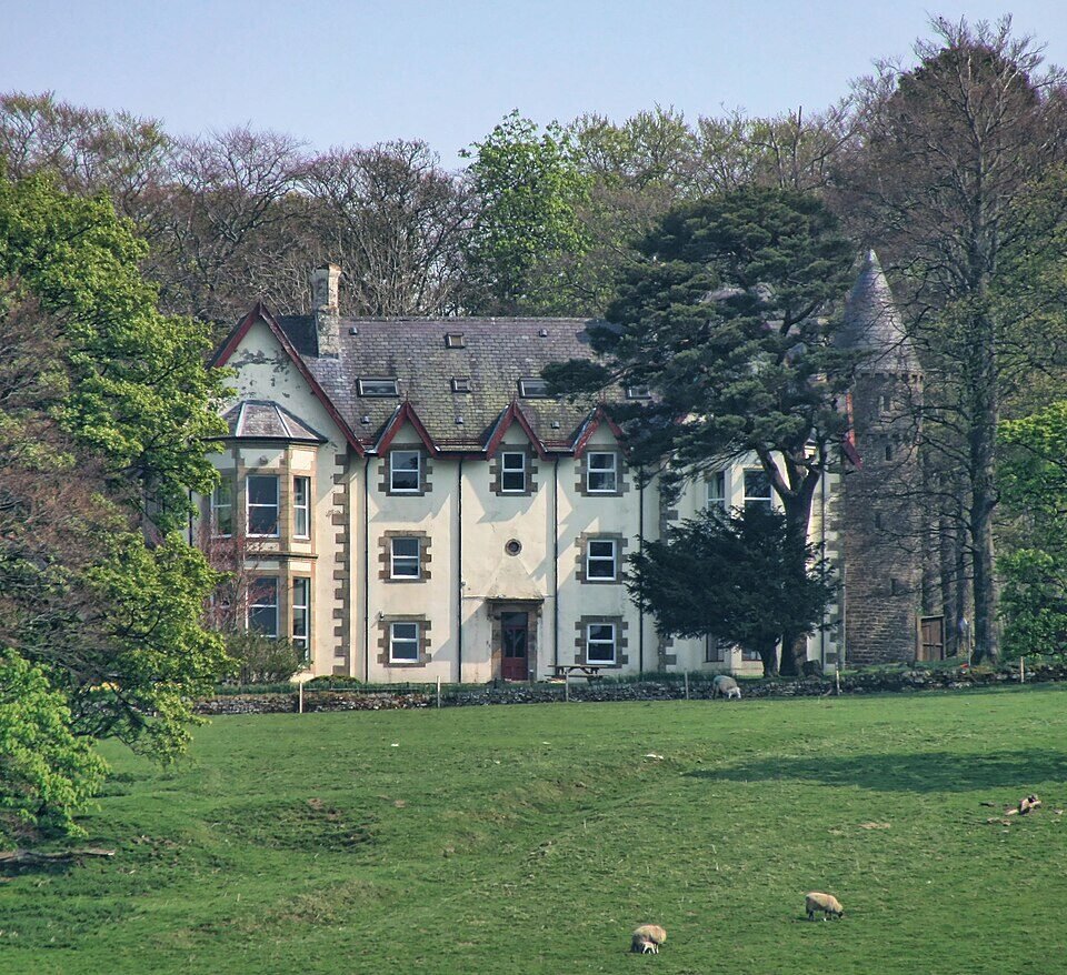
Basis: documented_manor_house — Barhaugh Hall, the documented former manor house and home of a branch of the Featherstonhaugh family. The site is identified at OS grid reference NY 695 512; the supplied WGS84 point is the geotagged position for Barhaugh Hall.
Point confidence: high
Boundary status: representative_point_only
Boundary period: 1853 archival boundary documentation identified, but not geographically recoverable from the accessible catalogue descriptions
Boundary confidence: none
Boundary basis: The record leads include a 1830 plan, 1850 valuation, 1853 boundary plan and 1853 perambulation for Barhaugh. These establish that detailed manorial extent evidence survives or formerly survived, but the accessible online descriptions do not provide the mapped perimeter, boundary landmarks or parcel schedule needed to construct a defensible polygon. The manor should not be substituted with the modern parish or civil-parish boundary.
Sources:
- Northumberland Archives, Manor History Files — Barhaugh listing: https://northumberlandarchives.com/manorial-project/manor-history-files/ — Lists Barhaugh among the identified Northumberland manors and distinguishes it from Kirkhaugh and other nearby manors.
- Co-Curate, Barhaugh Hall: https://co-curate.ncl.ac.uk/barhauh-hall/ — Identifies Barhaugh Hall as a medieval manor site, describes it as the former home of a branch of the Featherstonehaugh family, and gives OS grid reference NY6954051204.
- Geograph, Barhaugh Hall: https://www.geograph.org.uk/photo/2372120 — Identifies the subject as Barhaugh Hall and supplies the geotagged WGS84 position 54.85484, -2.47660 and OS reference NY 695 512.
- Richard Ford Manuscripts, 1822 deputation for the Manor of Barhaugh: https://dev.richardfordmanuscripts.co.uk/catalogue/16482 — Quotes a contemporary legal description referring to the 'Manor and Lands of Barhaugh' in the parish of Kirkhaugh, Northumberland.
- The National Archives, Barhaugh manor record F282462: https://discovery.nationalarchives.gov.uk/details/c/F282462 — Registry record for the supplied Barhaugh manor authority/reference.
- The National Archives, Barhaugh 1853 boundary plan ADM 75/233/17: https://discovery.nationalarchives.gov.uk/details/r/N16806820 — Catalogue lead for the 1853 manorial boundary plan; the accessible catalogue entry does not expose the plan image or boundary coordinates.
- The National Archives, Barhaugh 1853 perambulation ZCL/D/101: https://discovery.nationalarchives.gov.uk/details/r/N16806822 — Catalogue lead for the 1853 perambulation; the accessible catalogue entry does not expose the written boundary route.
Warnings / uncertainty:
- No defensible manorial-land polygon could be reconstructed from the accessible online evidence.
- The representative point marks Barhaugh Hall and should not be interpreted as the full historical extent of the manor.
- The modern parish or civil-parish boundary of Knaresdale with Kirkhaugh has not been used as a substitute for the manorial boundary.
- The 1853 boundary plan and perambulation should be consulted at the relevant repositories before attempting polygon reconstruction.
About the Manor
A manor at Kirkhaugh in Northumberland, recorded under the historical forms Berehalgh and Berehalve.
Records & References
Sources and references mentioning this manor/title which are not necessarily conveyances or transfers.
5 records found · showing 1–5.
1853-1853: perambulation
Held by: Northumberland Archives
1853-1853: boundary plan
Held by: The National Archives
1850-1850: description and valuation (1)
Held by: Northumberland Archives
1830-1830: plan
Held by: Newcastle City Library
1830-1830: plan
Held by: Northumberland Archives
Corrections / Challenges
Sign in to challenge or submit evidence against a recorded assertion.
JSON API
Machine-readable published manor data, including public images, mapped land areas, notes, rights, conveyances, relationships, records, source/document-library entries and public file links.
https://manorialregistry.com/index.php?rest_route=/mhr/v1/manor/barhaugh-4710Public API access is currently disabled. Authorised API clients must use a private X-MHR-API-Key; currently only administrator keys are enabled.
Private source files, pending edits, moderation/admin information, user API keys and non-public import identifiers are not returned.