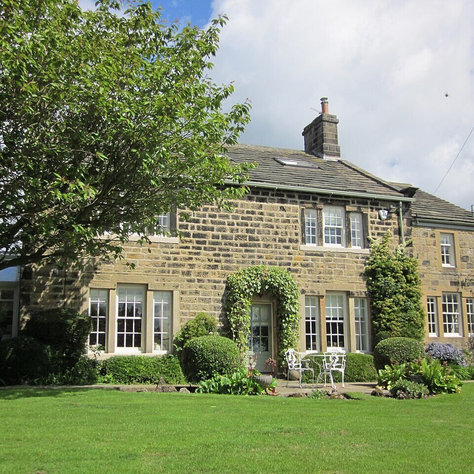



Historical names: Bardsey Cum Righton (Manor)
Location: Bardsey, Yorkshire
Places / associated places: Bardsey, Yorkshire
Location & Extent
GPS Location & Recorded Land Areas
Representative GPS point: 53.8855, -1.4429
Identity: confirmed — The supplied primary name, historical name, Bardsey Yorkshire location, TNA authority GB/NNAF/M170156, court rolls, and the 1729, 1735 and 1830 manor maps identify the manor associated with Bardsey and East Rigton in the historic West Riding of Yorkshire. The historical form "Righton" is a variant or transcription of Rigton.
Representative point: 53.8855, -1.4429
Basis: documented_estate_centre — Bardsey Grange, on Corn Mill Lane, is depicted on the 1735 Survey of the Manor and is associated with the historical Bardsey estate/manorial centre. Historic England identifies the surviving Bardsey Grange at National Grid Reference SE36714 43395, approximately 53.8855, -1.4429.
Point confidence: medium
Boundary status: representative_point_only
Boundary period: 1735, with earlier and later manorial continuity evidenced by the court rolls and maps
Boundary confidence: medium
Boundary basis: The accessible evidence establishes that the manor's surveyed territory included substantial parts of Bardsey and East Rigton, including the settlements, croft-and-toft plots, Rigton Farm, East Rigton Farm, Bardsey Grange and associated agricultural land. The 1735 survey specifically states or demonstrates that the Bingley Arms and land to its south, and Callister Hall, were outside the manor. However, the accessible catalogue descriptions and conservation-area appraisal do not provide a recoverable, coordinate-level perimeter for the entire manorial holding. The modern civil-parish boundary cannot be substituted for the historical manor boundary.
Sources:
- Bardsey-cum-Rigton Conservation Area Appraisal and Management Plan, Leeds City Council: https://www.leeds.gov.uk/docs/Bardsey%20conservation%20area%20appraisal%20and%20management%20plan.pdf — Describes the medieval history of the manor, the 1735 Survey of the Manor, the location of Bardsey Grange, the areas depicted at Bardsey and East Rigton, and the exclusion of the Bingley Arms and land to its south and Callister Hall.
- Bardsey Grange and Congreve Cottage Including Wall Attached to Rear, Historic England List Entry 1135656: https://historicengland.org.uk/listing/the-list/list-entry/1135656 — Provides the documented location of Bardsey Grange at NGR SE3671443395 and identifies the surviving historic grange building on Corn Mill Lane, Bardsey cum Rigton.
- 1735 manor map, TNA Discovery reference N14252735, ref. LF/M54: https://discovery.nationalarchives.gov.uk/details/r/N14252735 — Catalogue record for the 1735 map used in the conservation-area appraisal as the detailed Survey of the Manor.
- 1729 manor map with tenants' names, field names and acreages, TNA Discovery reference N14337784, ref. LF/117/6: https://discovery.nationalarchives.gov.uk/details/r/N14337784 — Catalogue record for an earlier detailed manor map associated with the Bardsey estate.
- Bardsey Manor, TNA Discovery record F244377: https://discovery.nationalarchives.gov.uk/details/c/F244377 — National Archives registry record corresponding to the supplied manor identity and authority/reference GB/NNAF/M170156.
Warnings / uncertainty:
- No coordinate-level historical manor polygon was recoverable from the accessible sources.
- The representative point is an estate/manorial-centre point at Bardsey Grange, not a claim that the present building footprint equals the historical manor boundary.
- Do not substitute the modern Bardsey cum Rigton civil-parish boundary for the historical manorial extent.
About the Manor
A historic manor at Bardsey, Yorkshire, associated with the locality and parish of Bardsey-cum-Rigton.
Records & References
Sources and references mentioning this manor/title which are not necessarily conveyances or transfers.
11 records found · showing 1–8.
1830- 1830: map showing copyhold and leasehold land
Held by: West Yorkshire Archive Service, Leeds
Further information: NRA 15 Lane Fox
1793-1803: call book
Held by: West Yorkshire Archive Service, Leeds
Further information: NRA 15 Lane Fox
1750-1926: court books (6)
Held by: West Yorkshire Archive Service, Leeds
Further information: NRA 12935
1735: map
Held by: West Yorkshire Archive Service, Leeds
Further information: NRA 15 Lane Fox
1729: map (with tenants' names, field names and acreages)
Held by: West Yorkshire Archive Service, Leeds
Further information: NRA 15 Lane Fox
1628-1632: court roll, with surrenders and admissions
Held by: Nottinghamshire Archives
Further information: NRA 6119 Savile
1574-1594: court roll
Held by: Nottinghamshire Archives
Further information: NRA 6119 Savile
1567-1568: court roll
Held by: Nottinghamshire Archives
Further information: NRA 6119 Savile
Corrections / Challenges
Sign in to challenge or submit evidence against a recorded assertion.
JSON API
Machine-readable published manor data, including public images, mapped land areas, notes, rights, conveyances, relationships, records, source/document-library entries and public file links.
https://manorialregistry.com/index.php?rest_route=/mhr/v1/manor/bardsey-manor-4691Public API access is currently disabled. Authorised API clients must use a private X-MHR-API-Key; currently only administrator keys are enabled.
Private source files, pending edits, moderation/admin information, user API keys and non-public import identifiers are not returned.