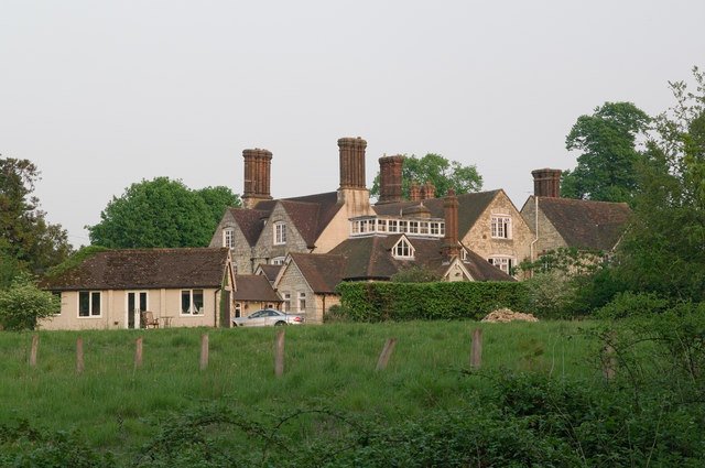



Location: Banstead, Surrey
Places / associated places: Banstead, Surrey
Location & Extent
GPS Location & Recorded Land Areas
Representative GPS point: 51.3219, -0.2007
Identity: confirmed — The registry record, its Banstead, Surrey location, and the associated medieval-to-modern Banstead manorial records correspond to the principal historic Manor of Banstead described in the Victoria County History. The record is distinct from subordinate or separately named manors and estates in the ancient parish, such as Preston, Great Burgh, Nork and Tadworth.
Representative point: 51.3219, -0.2007
Basis: documented_manor_house — The Victoria County History states that the Banstead manor-house was probably close to Banstead Church. Local church history records that the manor house was adjacent to All Saints Church and that medieval remains found south of the church may belong to it. The point is therefore placed immediately south of All Saints Church, near the probable manor-house site, rather than at a generic settlement centre.
Point confidence: medium
Boundary status: representative_point_only
Boundary period: Medieval to early modern, with later manorial continuity documented into the nineteenth and twentieth centuries
Boundary confidence: none
Boundary basis: No reliable published polygon or sufficiently explicit perimeter has been located for the historical manorial land of Banstead. The evidence demonstrates a substantial and geographically dispersed manor, not a boundary identical to the modern parish or civil administrative area. Known appurtenances and associated lands include Banstead village and downland, Banstead Woods and deer park, common and open-down areas, a mill at Beddington, Woodmansterne Mill at Carshalton, and common rights held by Banstead Manor tenants in Leigh and Horley in the area called the Weald in the 1325 survey. These references are insufficient to reconstruct a defensible continuous manor boundary without consulting the original 1325 survey, 1421 survey, 1680 manor survey, rentals, court rolls, estate maps or related archival plans.
Sources:
- The National Archives, Manorial Documents Register: Banstead Manor, F245691: https://discovery.nationalarchives.gov.uk/details/c/F245691 — Registry identity and associated manorial-record context for Banstead Manor.
- Victoria County History, A History of the County of Surrey, Volume 3, Banstead: https://en.wikisource.org/wiki/Page%3AThe_Victoria_History_of_the_County_of_Surrey_Volume_3.djvu/336 — Identifies the manor's historical status and states that the manor-house was probably close to Banstead Church; records Banstead Manor tenants' common rights in Leigh and Horley, called the Weald in the 1325 survey.
- Victoria County History, A History of the County of Surrey, Volume 3, Banstead parish: https://en.wikisource.org/wiki/Page%3AThe_Victoria_History_of_the_County_of_Surrey_Volume_3.djvu/335 — Records the likely Banstead Manor mill at Beddington, the Woodmansterne Mill appurtenance at Carshalton, medieval remains south of Banstead Church possibly belonging to the manor-house, and the geographical character of the ancient parish and downs.
- All Saints, Banstead: Church History: https://www.achurchnearyou.com/church/8081/page/83221/view/ — States that the manor house was adjacent to the church and that archaeological remains found south of the churchyard may belong to it.
- Historic England, Church of All Saints, Banstead, listing 1029028: https://historicengland.org.uk/listing/the-list/list-entry/1029028 — Provides the authoritative location of All Saints Church at National Grid Reference TQ 25471 59641, used to anchor the probable adjacent manor-house site.
- Banstead History Research Group, Places in Banstead: https://www.bansteadhistory.com/places_az.html — Summarizes the medieval association of Banstead Woods with the lord of Banstead Manor, including the deer park and hunting-lodge tradition, and records historical downland and common features.
Warnings / uncertainty:
- The representative point is a historically supported manor-house-site proxy immediately south of All Saints Church, not a surviving identified building footprint.
- No defensible historical manor polygon was found. Do not substitute the modern parish, civil parish, borough, conservation area or present-day Banstead Commons boundary.
- The manor had documented outlying appurtenances and rights beyond the immediate village, so its historical extent should not be inferred solely from the modern built-up area.
About the Manor
Historic manor associated with the parish and settlement of Banstead in Surrey.
Records & References
Sources and references mentioning this manor/title which are not necessarily conveyances or transfers.
31 records found · showing 25–31.
1401-1433: court rolls (3)
Held by: Surrey History Centre
Further information: NRA 3518 Surrey RO misc
1378-1384: court roll
Held by: Surrey History Centre
Further information: NRA 3518 Surrey RO misc
1353-1370: bailiff's accounts (6)
Held by: The National Archives
Further information: See SC6/1010/11-16;SC6/1010/11-16
1327- 1377: minister's account
Held by: The National Archives
Further information: See SC6/1010/18;SC6/1010/18
1277-1279: minister's account
Held by: The National Archives
Further information: See SC6/1010/10;SC6/1010/10
1275-1277: steward's account
Held by: The National Archives
Further information: See SC6/1010/9;SC6/1010/9
1275-1277: reeve's account
Held by: The National Archives
Further information: See SC6/1010/8;SC6/1010/8
Corrections / Challenges
Sign in to challenge or submit evidence against a recorded assertion.
JSON API
Machine-readable published manor data, including public images, mapped land areas, notes, rights, conveyances, relationships, records, source/document-library entries and public file links.
https://manorialregistry.com/index.php?rest_route=/mhr/v1/manor/banstead-manorPublic API access is currently disabled. Authorised API clients must use a private X-MHR-API-Key; currently only administrator keys are enabled.
Private source files, pending edits, moderation/admin information, user API keys and non-public import identifiers are not returned.