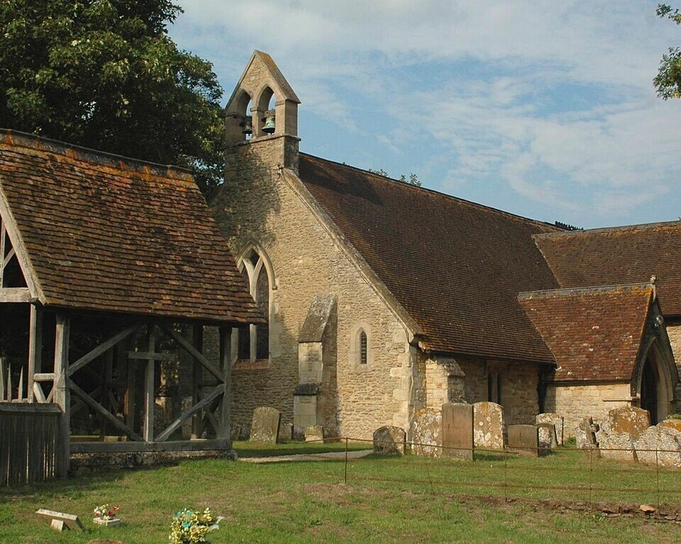



Historical names: Toot Baldon (Manor)
Location: Toot Baldon, Oxfordshire
Places / associated places: Toot Baldon, Oxfordshire
Location & Extent
GPS Location & Recorded Land Areas
Representative GPS point: 51.7031, -1.1812
Identity: confirmed — The supplied TNA/MDR record, GB/NNAF/M309658, places the manor at Toot Baldon. Historical evidence distinguishes a Baldon St Lawrence manor from a separate Toot Baldon manor, but records also describe Baldon St Lawrence as having appurtenances in Toot Baldon, Marsh Baldon, Little Baldon and Garsington. The Queen's College archive series supplied with the record is consistent with the long-term Queen's College lordship of these Baldon manors.
Representative point: 51.7031, -1.1812
Basis: documented_manor_house — The Manor House, Toot Baldon, is a documented Grade II* listed manor house at OS grid reference SP566007. It is the strongest surviving identifiable manorial centre for the registry record.
Point confidence: high
Boundary status: representative_point_only
Boundary period: Medieval to early modern manorial extent; later documented through Queen's College terriers, rentals, surveys and maps
Boundary confidence: none
Boundary basis: The accessible evidence confirms a non-parochial extent with appurtenances and parcels associated with Baldon St Lawrence in Toot Baldon, Marsh Baldon, Little Baldon and Garsington; a 1538 summary also mentions parcels in Stanton St John. The supplied Queen's College references include potentially decisive terriers, rentals, the 1716 map, the 1790 survey book and the 1831-1832 survey/map, but no accessible source located during this research provides a verifiable perimeter. The manor must not be substituted with the modern Toot Baldon civil-parish boundary.
Sources:
- The National Archives: Baldon St Lawrence Manor, TNA/MDR record F285624: https://discovery.nationalarchives.gov.uk/details/c/F285624 — Registry identity, authority/reference GB/NNAF/M309658 and location at Toot Baldon.
- A guide to the architectural antiquities in the neighbourhood of Oxford, section on Toot and Marsh Baldon: https://www.oahs.org.uk/publications/guide_4.pdf — Historical account distinguishing the manor of Baldon St Lawrence from the manor of Toot Baldon and stating that Baldon St Lawrence had appurtenances in Baldon St Lawrence, Toot Baldon, Marsh Baldon, Little Baldon and Garsington; it also records parcels associated with Stanton St John in the 1538 survey.
- Historic England: The Manor House, Toot Baldon, NHLE 1047998: https://historicengland.org.uk/listing/the-list/list-entry/1047998 — Identifies the surviving Grade II* Manor House at Toot Baldon, the defensible manorial-centre location used for the representative point.
- Bodleian Libraries, Map Catalogue: Oxfordshire maps: https://www.bodleian.ox.ac.uk/sites/default/files/bodreader/documents/media/maplist-3.pdf — Lists the Queen's College field map of Toot Baldon and Marsh Baldon, and the 1831-1832 plan of the open and common fields of both parishes, confirming relevant historical mapping leads but not supplying an accessible manor perimeter.
- Queen's College archival references in The National Archives Discovery: https://discovery.nationalarchives.gov.uk/details/r/N17052550 — The 1790 survey book, QCA 4A 120, is a relevant Queen's College manorial-survey lead for territorial reconstruction, but the catalogue record does not expose a mapped boundary.
Warnings / uncertainty:
- The historical sources distinguish Baldon St Lawrence Manor from a separate Toot Baldon Manor; the registry's alternative-name normalization should not be interpreted as proof that the two historical manors had identical extents.
- The representative point is safe for locating the manor centre, but no historically grounded polygon could be verified from accessible evidence.
- The modern Toot Baldon civil-parish boundary, parish area and administrative boundaries have not been used as a substitute for the manorial extent.
About the Manor
A manor associated with Toot Baldon, Oxfordshire, also recorded under the historical name Toot Baldon (Manor).
Records & References
Sources and references mentioning this manor/title which are not necessarily conveyances or transfers.
25 records found · showing 1–8.
1905-1930: annual rent rolls of cottages and gardens, with Wendlebury
Held by: Oxford University: Queen's College Library
1831-1832: map (see survey book QCA 4A 141)
Held by: Oxford University: Queen's College Library
1831-1832: survey book (see map QCA 4A 218)
Held by: Oxford University: Queen's College Library
1800-1800: customs rel to allotting the 'lott-meads'
Held by: Oxford University: Queen's College Library
1799-1799: map (copy made 18th cent)
Held by: Oxford University: Queen's College Library
1790-1899: survey book 1790 (with 19th cent notes)
Held by: Oxford University: Queen's College Library
1730-1730: court rolls (extract, homage only)
Held by: Oxford University: Queen's College Library
1721-1721: terrier
Held by: Oxford University: Queen's College Library
Corrections / Challenges
Sign in to challenge or submit evidence against a recorded assertion.
JSON API
Machine-readable published manor data, including public images, mapped land areas, notes, rights, conveyances, relationships, records, source/document-library entries and public file links.
https://manorialregistry.com/index.php?rest_route=/mhr/v1/manor/baldon-st-lawrence-manorPublic API access is currently disabled. Authorised API clients must use a private X-MHR-API-Key; currently only administrator keys are enabled.
Private source files, pending edits, moderation/admin information, user API keys and non-public import identifiers are not returned.