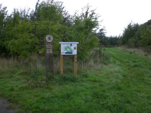



Location: Bagworth, Leicestershire
Places / associated places: Bagworth, Leicestershire
Location & Extent
GPS Location & Recorded Land Areas
Representative GPS point: 52.67329, -1.32894
Identity: confirmed — The registry location and associated place identify Bagworth in Leicestershire. Medieval evidence independently identifies a manor of Bagworth extending in Bagworth and Thornton, while the 1464 conveyance records the manors of Bagworth and Thornton together with specified land, meadow, pasture and woodland in Bagworth, Thornton and Desford. The associated TNA/MDR records, including the 1587 survey lead, are consistent with this Bagworth and Thornton manorial complex and not with another same-named manor.
Representative point: 52.67329, -1.32894
Basis: documented_manor_site — The documented moated manorial site known as Bagworth Moats lies approximately 1 km north-east of Bagworth village. Historic England identifies it as the site of the medieval manor house, with documentary evidence from 1279 onward, including the 1318 licence to crenellate and later occupation of the site.
Point confidence: medium
Boundary status: representative_point_only
Boundary period: Medieval to late medieval, with extent evidence especially clear in the 14th-15th centuries
Boundary confidence: none
Boundary basis: No reliable source located provides a complete mapped perimeter of the historical Bagworth manor. The 1408 inquisition states that the manor extended in Bagworth and Thornton. The 1464 Feet of Fines records 500 acres of land, 200 acres of meadow, 400 acres of pasture and 200 acres of wood in Bagworth, Thornton and Desford, but does not define the perimeter. The 1474 licence to crenellate refers to a 2,000-acre park associated with Bagworth and Thornton, again without a boundary map. These records establish the manor's territorial association and approximate scale but do not justify reconstructing a polygon. The modern civil parish or settlement boundary must not be substituted for the historical manorial boundary.
Sources:
- Historic England: Moat with fishponds at Bagworth, Bagworth & Thornton, List Entry 1010485: https://historicengland.org.uk/listing/the-list/list-entry/1010485 — Identifies the moated site as an unusually well-documented manorial site; places it 1 km north-east of Bagworth; describes the medieval house, fishponds, park evidence and documentary history from 1279, 1318 and the 15th century.
- The Gatehouse Gazetteer: Bagworth Moats: https://gatehouse-gazetteer.info/English%20sites/1757.html — Provides the coordinate 52.67329, -1.32894 and identifies Bagworth Moats as a probable fortified manor-house site, also recording the historical association with Bagworth and Thornton.
- Mapping the Medieval Countryside: Inquisition Post Mortem, Leicestershire, 1408: https://inquisitionspostmortem.ac.uk/view/inquisition/19-404/414.html — States that the manor of Bagworth extended in Bagworth and Thornton and gives its annual value and feudal tenure.
- Feet of Fines: CP 25/1/126/78, no. 8: https://www.medievalgenealogy.org.uk/fines/abstracts/CP_25_1_126_78.shtml — Records William Hastings's 1464 acquisition of the manors of Bagworth and Thornton and specified areas of land, meadow, pasture and wood in Bagworth, Thornton and Desford.
- The Gatehouse Gazetteer: Licence to crenellate at Bagworth, 1474: https://gatehouse-gazetteer.info/LOC/14740417b.html — Records the 1474 royal licence concerning Bagworth and Thornton and the associated 2,000-acre park, supporting the scale and joint territorial context of the manorial lands.
- The National Archives: Bagworth Manor, TNA/MDR record F284913: https://discovery.nationalarchives.gov.uk/details/c/F284913 — Registry record supplied for the exact Bagworth Manor entry, used as the identity anchor.
Warnings / uncertainty:
- The returned point represents the documented historical manor-house/manorial site, not the centre of the modern village.
- No defensible historical manor-land polygon was found. Do not inject a polygon based on the modern Bagworth and Thornton civil parish, parish, ward or settlement boundary.
- Bagworth and Thornton were historically distinct but adjoining manors in some records, despite shared ownership and possible administration from the Bagworth moated site.
- The 2,000-acre figure in the 1474 licence describes parkland associated with Bagworth and Thornton and should not be treated as a surveyed manor boundary.
About the Manor
A manor associated with Bagworth in Leicestershire. No further positively recognised description is added without source verification.
Records & References
Sources and references mentioning this manor/title which are not necessarily conveyances or transfers.
7 records found · showing 1–7.
1587-1587: survey
Held by: Huntington Library
Further information: NRA 10029 Hastings
1585-1589: court rolls (2)
Held by: Huntington Library
Further information: NRA 10029 Hastings
1568-1569: court roll
Held by: Huntington Library
Further information: NRA 10029 Hastings
1484-1485: court roll
Held by: Huntington Library
Further information: NRA 10029 Hastings
1466-1478: account rolls, with Thornton and other manors (7)
Held by: Huntington Library
Further information: NRA 10029 Hastings
1445-1447: ministers' accounts
Held by: Lancashire Archives
Further information: NRA 53 Stanley
1341-1344: schedule of decayed rents
Held by: The National Archives
Corrections / Challenges
Sign in to challenge or submit evidence against a recorded assertion.
JSON API
Machine-readable published manor data, including public images, mapped land areas, notes, rights, conveyances, relationships, records, source/document-library entries and public file links.
https://manorialregistry.com/index.php?rest_route=/mhr/v1/manor/bagworth-manorPublic API access is currently disabled. Authorised API clients must use a private X-MHR-API-Key; currently only administrator keys are enabled.
Private source files, pending edits, moderation/admin information, user API keys and non-public import identifiers are not returned.