


Historical names: Alyston (Manor) | Aylmeton (Manor)
Location: Aylton, Herefordshire
Places / associated places: Aylton, Herefordshire
Location & Extent
GPS Location & Recorded Land Areas
Representative GPS point: 52.03619, -2.49998
Identity: confirmed — The registry name, historical forms, Aylton/Herefordshire location, and the associated archival references identify the medieval and later manor of Aylton in the Aylton parish area, not another same-named manor. Historical evidence links the manor and its advowson to the Walwyn and later Harley interests, with the surviving Court Farm complex forming the strongest identified manorial centre.
Representative point: 52.03619, -2.49998
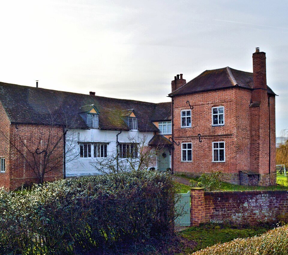
Basis: documented_manor_house — Aylton Court Farm/Court Farm is the historic manorial or estate centre beside Aylton church, associated with the manor's ownership and advowson. The surviving house and its early-sixteenth-century manorial barn occupy the documented Court Farm site at approximately OS grid SO 658 376/377.
Point confidence: medium
Boundary status: representative_point_only
Boundary period: Medieval to early modern; extent evidence particularly concerns 1293 and the early sixteenth century
Boundary confidence: none
Boundary basis: Sources describe the manor's territorial resources but do not provide a recoverable perimeter. In 1293 the estate was recorded as approximately 279 acres, including Ast Wood, with 38 free tenants; by 1532 it was described as including 24 dwellings and 414 acres, including 100 acres of wood and 12 acres of heath. A field called Aylton Castle Field, recorded on the 1839 tithe map, indicates a possible earlier manorial centre northwest of the church, but neither that evidence nor the acreage descriptions establishes the complete manorial boundary. The historical manor should therefore not be substituted with the modern civil-parish boundary.
Sources:
- The National Archives, Aylton manor record F280353: https://discovery.nationalarchives.gov.uk/details/c/F280353 — Registry record for the Aylton manor, authority/reference GB/NNAF/M303561.
- Herefordshire Archaeology and History, HAN 79: https://www.woolhopeclub.org.uk/system/files/documents/han/han-79.pdf — Discusses the Aylton manor, its holders, the Walwyn and Harley connections, and identifies the surviving Aylton Court Farm complex and its manorial barn.
- Aylton Court Farm, Geograph: https://www.geograph.org.uk/photo/644687 — Places Aylton Court Farm and the parish church together at approximately WGS84 52.03619, -2.49998; describes the substantial house as built up over several centuries.
- Oxford Tree-Ring Laboratory, Herefordshire buildings: https://www.dendrochronology.us/herefordshire.html — Records Court Farm Barn, Aylton, at OS SO 658 377, with timbers felled in winter 1502/3, supporting the identification of the Court Farm complex as a historic manorial centre.
- Herefordshire Through Time, Court Farm and Moat, Aylton: https://htt.herefordshire.gov.uk/her-search/sources/search/source?ID=SHE17621 — County heritage database entry identifying Court Farm and Moat, Aylton, as a recorded archaeological and historic site.
- Aylton Castle Field, The Gatehouse Gazetteer: https://gatehouse-gazetteer.info/English%20sites/1318.html — Identifies Aylton Castle Field at OS SO 658 380 and records the field-name evidence from the 1839 tithe map, with a cautious interpretation as a possible earlier small manorial centre.
- Herefordshire place-names: Aylton: https://www.melocki.org.uk/places/A.html — Documents the historical forms Aylmeton and Alyston, corroborating the registry's saved alternative names.
Warnings / uncertainty:
- No authoritative manor map, rental map, tithe reconstruction, enclosure plan, or other source establishing the complete historical perimeter was located.
- The figures of 279 acres in 1293 and 414 acres in 1532 describe recorded estate resources and must not be treated as a polygon or as equivalent to the modern parish area.
- Aylton Court Farm is the best-supported surviving manorial centre, but Aylton Castle Field may represent an earlier manorial site; the evidence does not establish whether the two sites belonged to distinct phases of the same centre or how the land was bounded.
- The representative coordinate is suitable for locating the manor record but should not be interpreted as the centre of the entire historical manor.
About the Manor
A manor associated with the village and parish of Aylton in Herefordshire.
Records & References
Sources and references mentioning this manor/title which are not necessarily conveyances or transfers.
2 records found · showing 1–2.
1645-1646: estreats
Held by: The National Archives
1447-1449: bailiff and receiver's view of account, with other manors
Held by: Herefordshire Archive and Records Centre
Further information: NRA 4677 Walwyn
Corrections / Challenges
Sign in to challenge or submit evidence against a recorded assertion.
JSON API
Machine-readable published manor data, including public images, mapped land areas, notes, rights, conveyances, relationships, records, source/document-library entries and public file links.
https://manorialregistry.com/index.php?rest_route=/mhr/v1/manor/ayltonPublic API access is currently disabled. Authorised API clients must use a private X-MHR-API-Key; currently only administrator keys are enabled.
Private source files, pending edits, moderation/admin information, user API keys and non-public import identifiers are not returned.