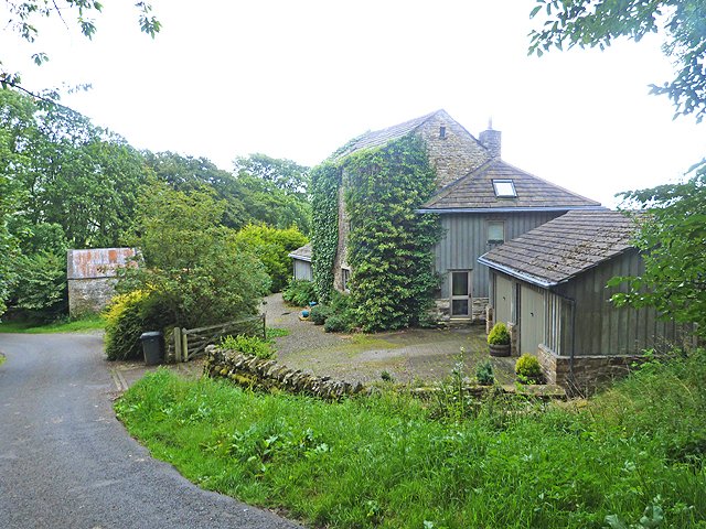



Historical names: Ale (Manor) | Alne (Manor)
Location: Kirkhaugh, Northumberland
Places / associated places: Kirkhaugh, Northumberland
Location & Extent
GPS Location & Recorded Land Areas
Representative GPS point: 54.838008, -2.441218
Identity: confirmed — The Northumberland Archives manor history file explicitly identifies Ayle, with aliases Ale and Alne, as a separate manor closely associated with Kirkhaugh. This matches the registry primary name, alternative names, location, and authority context. The file also links the manor to the recorded Ayle/Alne boundary material and later Greenwich Hospital ownership.
Representative point: 54.838008, -2.441218
Basis: settlement_proxy — Ayle hamlet, identified by the manor history file and historical directories as the location of the manor/manorial settlement within Kirkhaugh. No distinct surviving manor-house site has been securely identified in the available evidence; the point uses the documented Ayle hamlet location rather than the wider Kirkhaugh parish centre.
Point confidence: medium
Boundary status: representative_point_only
Boundary period: Insufficiently defined; references span the medieval period to 1853 and later manorial administration.
Boundary confidence: none
Boundary basis: The available evidence confirms that Ayle/Alne was a distinct manor associated with Kirkhaugh, and that a boundary plan existed in 1853 (TNA ADM 75/233/17). However, the accessible catalogue evidence does not reproduce the plan or provide a sufficiently explicit list of boundary landmarks or parcels from which a historical polygon can be reconstructed. The 1258 boundary evidence cited in the manor history file concerns the manor of Kirkhaugh and cannot safely be substituted for the separate manor of Ayle. Ayle was later described as a hamlet within the township of Kirkhaugh, suggesting administrative or manorial association but not establishing that the Ayle manor occupied the whole township or parish.
Sources:
- Northumberland Archives, Manor History File: Ayle: https://northumberlandarchives.com/wp-content/uploads/2025/01/Manor-History-File-AYLE.pdf — Identifies Ayle and the aliases Ale and Alne; states that Ayle was closely associated with but distinguished from Kirkhaugh; records the descent of the manors, their acquisition by Greenwich Hospital, the 1825 intention to ride the boundaries of Kirkhaugh and Alne, and the later description of Ayle as a hamlet within Kirkhaugh.
- The National Archives, Manorial Documents Register record F282483: https://discovery.nationalarchives.gov.uk/details/c/F282483 — Registry record supplied for the exact manor Ayle, associated with Kirkhaugh, Northumberland.
- The National Archives, ADM 75/233/17, boundary plan, 1853: https://discovery.nationalarchives.gov.uk/details/r/N16806821 — Confirms the existence of a 1853 boundary-plan record relevant to the manor research, but the accessible catalogue record does not expose the plan's geographic contents.
- The National Archives, ADM 76/83, enfranchisement bundle, 1601-1900: https://discovery.nationalarchives.gov.uk/details/r/N16804125 — Confirms surviving enfranchisement material for the manor, potentially relevant to historical parcels and tenure, but no mapped extent is available in the accessible record.
- Northumberland Archives, NRO 7417/1/6/1, rents with Whitlaw, 1900-1907: https://discovery.nationalarchives.gov.uk/details/r/N16806940 — Confirms later rental material linking Ayle with Whitlaw; the accessible catalogue record does not provide parcel-level geography.
- Gazetteer of British Place Names, Ayle, Northumberland: https://gazetteer.org.uk/place/Ayle%2C_Northumberland_1771 — Provides the documented Ayle hamlet location at latitude 54.838008 and longitude -2.441218, grid reference NY 7175 4933.
- Directory entry for Kirkhaugh, Northumberland: https://leicester.contentdm.oclc.org/digital/api/collection/p16445coll4/id/320520/download — Describes Ayle as a hamlet in the Kirkhaugh township and records the wider manorial context of Greenwich Hospital ownership.
Warnings / uncertainty:
- No reliable accessible source supplies the actual perimeter of the Ayle/Alne manor.
- The 1853 boundary plan is an important lead, but its mapped content was not available through the accessible catalogue record.
- The medieval boundary description available in the manor history file relates to Kirkhaugh and must not be treated as the boundary of Ayle without examining the original evidence.
- The representative point is a documented hamlet-centre proxy, not a surveyed manor-house coordinate or a boundary centroid.
About the Manor
Ayle, also recorded as Ale or Alne, is a manor associated with Kirkhaugh in Northumberland.
Records & References
Sources and references mentioning this manor/title which are not necessarily conveyances or transfers.
3 records found · showing 1–3.
1900-1907: rents, with Whitlaw (1 vol)
Held by: Northumberland Archives
1853-1853: boundary plan
Held by: The National Archives
1601-1900: enfranchisement (1 bundle)
Held by: The National Archives
Corrections / Challenges
Sign in to challenge or submit evidence against a recorded assertion.
JSON API
Machine-readable published manor data, including public images, mapped land areas, notes, rights, conveyances, relationships, records, source/document-library entries and public file links.
https://manorialregistry.com/index.php?rest_route=/mhr/v1/manor/aylePublic API access is currently disabled. Authorised API clients must use a private X-MHR-API-Key; currently only administrator keys are enabled.
Private source files, pending edits, moderation/admin information, user API keys and non-public import identifiers are not returned.