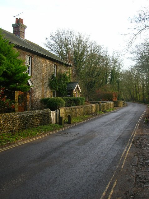



Historical names: Adrington (Manor) | Adryngton (Manor) | Bailiffscourt (Manor)
Location: Climping, Sussex
Places / associated places: Climping, Sussex
Location & Extent
GPS Location & Recorded Land Areas
Representative GPS point: 50.79894, -0.57933
Identity: confirmed — The record is securely identified with the manor historically called Atherington, also appearing as Adrington or Adryngton and later associated with Bailiffscourt. The West Sussex Record Office catalogues a 1606 John Norden map specifically as the map of Atherington Manor in Littlehampton and Climping. Historic England independently identifies the surviving Bailiffscourt Chapel as originally attached to the house of the bailiff of the Abbey of Séez, linking the Bailiffscourt site to the Atherington manor/grange.
Representative point: 50.79894, -0.57933
Basis: documented_manor_house — Bailiffscourt Chapel survives at the former Atherington manor/grange site. Historic England gives its National Grid Reference as TQ0021500897 and describes it as originally attached to the house of the bailiff of the Abbey of Séez. The decimal coordinates are the WGS84 conversion of that documented site.
Point confidence: high
Boundary status: representative_point_only
Boundary period: 1606 map evidence, with medieval and early-modern territorial continuity
Boundary confidence: none
Boundary basis: A detailed 1606 estate map by John Norden exists for Atherington Manor in Littlehampton and Climping and depicts manor lands, settlements, common areas, roads, marshland and coastal holdings. Related evidence indicates that the manor's lands extended across both Littlehampton and Climping and that parts of the historic coastal settlement and land were subsequently lost to erosion. However, the accessible evidence does not provide a sufficiently georeferenced and unambiguous perimeter from which to construct a defensible polygon. The modern parish or later Bailiffscourt estate cannot safely be substituted for the historical manorial boundary.
Sources:
- West Sussex Record Office: Mapping West Sussex – Part Two: County Orienteering and Plotting Estates: https://westsussexrecordofficeblog.com/2021/02/01/mapping-west-sussex-part-two-county-orienteering-and-plotting-estates/ — Identifies Add Mss 2031 as John Norden's 1606 map of Atherington Manor in Littlehampton and Climping.
- John Norden's 1606 map of Atherington Manor, Add Mss 2031: https://i0.wp.com/westsussexrecordofficeblog.com/wp-content/uploads/2020/11/add-mss-2031.png?resize=770%2C483&ssl=1 — The archival map image shows the titled 'Adryngton Maner' district and mapped lands around Atherington, Littlehampton, Climping, Cudlow, Strootland and the coastal area.
- Historic England: Chapel at Bailiffscourt Hotel, Climping, List Entry 1233450: https://historicengland.org.uk/listing/the-list/list-entry/1233450 — Places the surviving chapel at TQ0021500897 and states that it was originally attached to the house of the bailiff of the Abbey of Seez in Normandy.
- Bailiffscourt / Manor of Atherington, Parks & Gardens: https://www.parksandgardens.org/places/bailiffscourt — Identifies Bailiffscourt as the Manor of Atherington, describes the historic grange/manor site and moat, and records the later Bailiffscourt estate as substantially larger than the surviving manor-site complex.
- The National Archives: Atherington Manor registry record F255161: https://discovery.nationalarchives.gov.uk/details/c/F255161 — Supplied registry record and authority reference for the exact manor identification.
Warnings / uncertainty:
- The representative point identifies the documented historic manor/grange site at Bailiffscourt, not the later 1931–1935 country house as a medieval building.
- The 1606 map demonstrates the manor's mapped territorial context but has not been reliably georeferenced here into a historical boundary polygon.
- Atherington's coastal extent changed through erosion; the historic manorial lands should not be inferred from the modern shoreline or modern Climping parish boundary.
About the Manor
A manor at Climping, Sussex, historically known as Adrington, Adryngton, and Bailiffscourt Manor.
Records & References
Sources and references mentioning this manor/title which are not necessarily conveyances or transfers.
23 records found · showing 9–16.
1539-1546: ministers' accounts, with other manors
Held by: The National Archives
1539-1541: ministers' accounts, with other manors
Held by: Collection held privately: enquiries to West Sussex Record Office
Further information: NRA 15719 Wyndham (Petworth)
1514-1516: fines and heriots, with other manors
Held by: The National Archives
1509-1521: ministers' accounts, with other manors (10)
Held by: The National Archives
1508-1539: ministers' accounts, with other manors
Held by: The National Archives
1502-1505: fines and heriots, with other manors
Held by: The National Archives
1485-1499: court rolls, with other manors
Held by: The National Archives
1485-1509: ministers' accounts, with other manors
Held by: The National Archives
Further information: NRA 850 Gordon Lennox
Corrections / Challenges
Sign in to challenge or submit evidence against a recorded assertion.
JSON API
Machine-readable published manor data, including public images, mapped land areas, notes, rights, conveyances, relationships, records, source/document-library entries and public file links.
https://manorialregistry.com/index.php?rest_route=/mhr/v1/manor/atherington-manor-2Public API access is currently disabled. Authorised API clients must use a private X-MHR-API-Key; currently only administrator keys are enabled.
Private source files, pending edits, moderation/admin information, user API keys and non-public import identifiers are not returned.