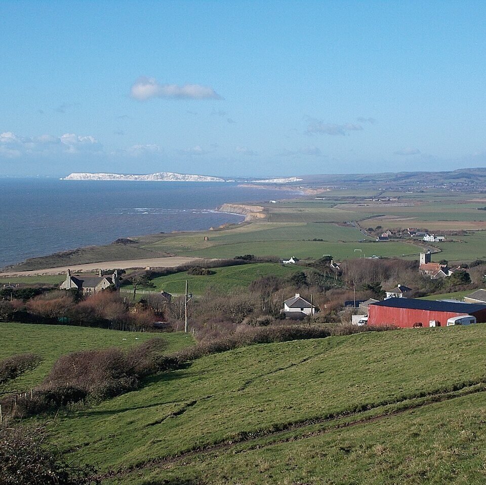



Location: Shorwell, Isle of Wight
Places / associated places: Shorwell, Isle of Wight
Location & Extent
GPS Location & Recorded Land Areas
Representative GPS point: 50.6122, -1.3364
Identity: confirmed — The registry record's Atherfield/Shorwell identification is corroborated by Historic England's record for Atherfield Farmhouse, which describes the building as an original Domesday manor at Atherfield in Shorwell. Medieval evidence also identifies a manor of Atherfeld in the Isle of Wight, with land in Atherfeld and Brigheston.
Representative point: 50.6122, -1.3364
Basis: documented_manor_house — Atherfield Farmhouse, Atherfield Road, Shorwell, National Grid Reference SZ 47048 79379; Historic England describes it as an original Domesday manor and the surviving manor-house candidate for Atherfield Manor.
Point confidence: high
Boundary status: representative_point_only
Boundary period: Medieval; specifically documented in 1459, with earlier estate-bound evidence from the tenth century
Boundary confidence: medium
Boundary basis: The 1459 Feet of Fines records the manor of Atherfeld with 200 acres of land, 100 acres of meadow, 100 acres of pasture, 20 acres of wood and 10 acres of moor in Atherfeld and Brigheston, totalling 430 acres. A scholarly reconstruction of the earlier two-hide Atherfield estate places its broad extent between Shepherd's Chine and Whale Chine and identifies historic watercourses and the later Brighstone-parish detached area as relevant boundaries. However, the available evidence does not provide a sufficiently reliable, manor-specific perimeter for a GIS polygon: the reconstructed tenth-century estate cannot safely be treated as identical to the later manorial land, and the 1459 acreage record supplies no mapped boundary.
Sources:
- Atherfield Farmhouse, Shorwell - Historic England List Entry 1292651: https://historicengland.org.uk/listing/the-list/list-entry/1292651 — Provides the manor-house candidate, parish, National Grid Reference SZ 47048 79379, and states that Atherfield Farmhouse is an original Domesday manor.
- Feet of Fines: CP 25/1/207/33, number 46: https://www.medievalgenealogy.org.uk/fines/abstracts/CP_25_1_207_33.shtml — Records the manor of Atherfeld in the Isle of Wight and 430 acres of associated land in Atherfeld and Brigheston on 3 November 1459.
- The Anglo-Saxon Charter Bounds of the Isle of Wight, part 1: https://iwnhas.org/wp-content/uploads/2026/02/Margham-Anglo-Saxon-Charter-Bounds-West-Medine-Wight-Studies-Vol-21-2005.pdf — Discusses the lost Atherfield charter, Domesday entries, and a plausible reconstruction of the earlier two-hide Atherfield estate using Shepherd's Chine, Whale Chine, watercourses and historic parish boundaries.
- Atherfield Coastal Plain Historic Environment Assessment: https://digitalservices.iow.gov.uk/documents/download/atherfieldcoastal-20plainheap-2013 — Identifies the Atherfield area with historic boundaries associated with the Anglo-Saxon Atherfield estate and states that the medieval estate corresponded to Atherfield Farm.
- National Archives Discovery: F237979: https://discovery.nationalarchives.gov.uk/details/c/F237979 — Registry record supplied for Atherfield Manor, associated with Shorwell, Isle of Wight.
Warnings / uncertainty:
- No defensible exact historical polygon was found in the accessible evidence.
- The 430-acre figure is a documented medieval extent, not a mapped perimeter.
- The published reconstruction between Shepherd's Chine and Whale Chine concerns the earlier Atherfield estate and should not automatically be injected as the boundary of the later manor.
Records & References
Sources and references mentioning this manor/title which are not necessarily conveyances or transfers.
1 record found · showing 1–1.
1272-1276: ministers accounts, with other manors
Held by: The National Archives
Corrections / Challenges
Sign in to challenge or submit evidence against a recorded assertion.
JSON API
Machine-readable published manor data, including public images, mapped land areas, notes, rights, conveyances, relationships, records, source/document-library entries and public file links.
https://manorialregistry.com/index.php?rest_route=/mhr/v1/manor/atherfield-manorPublic API access is currently disabled. Authorised API clients must use a private X-MHR-API-Key; currently only administrator keys are enabled.
Private source files, pending edits, moderation/admin information, user API keys and non-public import identifiers are not returned.