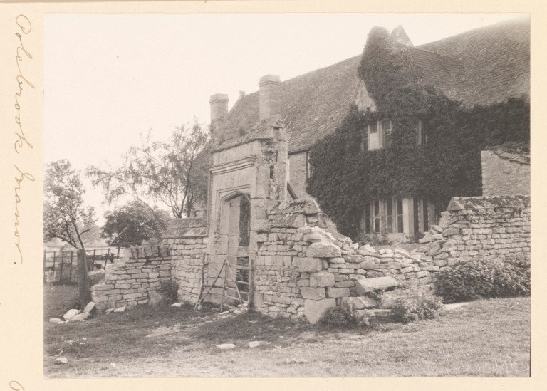



Location: Polebrook, Northamptonshire
Places / associated places: Polebrook, Northamptonshire
Location & Extent
GPS Location & Recorded Land Areas
Representative GPS point: 52.4614, -0.4378
Identity: confirmed — The registry record F278935 names ARMSTON MANOR at Polebrook, Northamptonshire, matching the historically documented Armston lordship/manor in Polebrook parish. The Northamptonshire Historic Environment Record identifies Armston as a former settlement and records the 1716 Map of Armston; related archival evidence identifies an Armston estate associated with the Montagu/Buccleuch holdings.
Representative point: 52.4614, -0.4378
Basis: documented_manor_house — Approximate WGS84 conversion of OS Grid Reference TL0614 8591, identified by the Northamptonshire Historic Environment Record as the site of a farmhouse/manor-house complex east of Armston Green. The farmhouse was demolished around 1890, with material used in an extension to the Manor House.
Point confidence: medium
Boundary status: representative_point_only
Boundary period: c.1716, with earlier and later extent not securely established
Boundary confidence: medium
Boundary basis: A 1716 Map of Armston, also described by Historic England as a drawing based on John Booth's 1716 map of the Lordship of Armston, is recorded in the Northamptonshire Historic Environment Record and is held at Northamptonshire Record Office. Scholarly archival research states that the Armston estate embraced land in Kingsthorpe as well as Armston/Polebrook. However, the accessible evidence does not provide a georeferenced copy or sufficiently explicit perimeter data from which a defensible historical manorial polygon can be reconstructed. The modern Polebrook civil-parish boundary must not be substituted for the manor boundary.
Sources:
- The National Archives: ARMSTON MANOR, TNA/MDR record F278935: https://discovery.nationalarchives.gov.uk/details/c/F278935 — Registry record identifying the exact manor as Armston Manor in Polebrook, Northamptonshire.
- Northamptonshire Historic Environment Record: 2206 - Armston: https://her.northamptonshire.gov.uk/Monument/MNN4580 — Documents Armston's historical settlement/manorial context, its association with Polebrook, the 1716 Map of Armston, and the former manor-house-related site at approximately TL0614 8591.
- Northamptonshire Historic Environment Record: 2206/2 - Street Close, Armston DMV: https://her.northamptonshire.gov.uk/Monument/MNN21623 — Records the historical house/farmhouse at TL0614 8591, its demolition around 1890, and its relationship to the Manor House and Armston's medieval religious and manorial remains.
- Northamptonshire Historic Environment Record: SNN6170 - Map of Armston: https://her.northamptonshire.gov.uk/Source/SNN6170 — Catalogues the 1716 Map of Armston, held at Northamptonshire Record Office, and links it to the Armston monument complex.
- Northamptonshire Past & Present, volume 5, no. 3: https://www.northamptonshirerecordsociety.org.uk/pdf/npp/volume-5/npp-v5-n3.pdf — States that the Montagu family bought the Armston estate in 1548 and that the estate embraced land in Kingsthorpe.
- Historic England Archive item 890484: RCHME drawing based on the 1716 Lordship of Armston map: https://historicengland.org.uk/images-books/photos/item/890484 — Confirms the existence and historical relevance of a drawing based on John Booth's 1716 map of the Lordship of Armston.
Warnings / uncertainty:
- The representative point is based on a documented historical manor-house site, not the modern locality centroid.
- No defensible polygon is returned because the accessible sources confirm the existence and broad territorial relationships of the lordship but do not expose a georeferenced boundary map or sufficiently detailed perimeter description.
- The Armston estate included land in Kingsthorpe; therefore the modern Polebrook parish boundary would be an unsafe substitute for the historical manorial extent.
Records & References
Sources and references mentioning this manor/title which are not necessarily conveyances or transfers.
6 records found · showing 1–6.
1716-1716: map of lordship
Held by: Boughton House
1570-1570: terrier
Held by: Northamptonshire Archives Service
Further information: NRA 23059 Montagu-Douglas-Scot
1545-1548: bailiff's accounts, with other manors (2 vols)
Held by: Northamptonshire Archives Service
1520-1550: note of rents
Held by: Northamptonshire Archives Service
Further information: NRA 23059 Montagu-Douglas-Scot
1500-1540: rental (Aldwinkle Chantry)
Held by: Northamptonshire Archives Service
Further information: NRA 23059 Montagu-Douglas-Scot
1500-1540: survey (Aldwinkle Chantry)
Held by: Northamptonshire Archives Service
Further information: NRA 23059 Montagu-Douglas-Scot
Corrections / Challenges
Sign in to challenge or submit evidence against a recorded assertion.
JSON API
Machine-readable published manor data, including public images, mapped land areas, notes, rights, conveyances, relationships, records, source/document-library entries and public file links.
https://manorialregistry.com/index.php?rest_route=/mhr/v1/manor/armston-manorPublic API access is currently disabled. Authorised API clients must use a private X-MHR-API-Key; currently only administrator keys are enabled.
Private source files, pending edits, moderation/admin information, user API keys and non-public import identifiers are not returned.