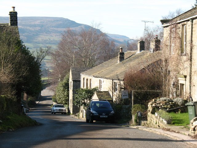



Location: Burnsall, Yorkshire
Places / associated places: Burnsall, Yorkshire
Location & Extent
GPS Location & Recorded Land Areas
Representative GPS point: 54.0368, -1.91846
Identity: confirmed — The National Archives record F244996 is explicitly titled APPLETREEWICK MANOR, carries authority reference GB/NNAF/M170360, and associates the record with Burnsall, Yorkshire. The archival record lists medieval ministers' accounts, boundary rolls, court books, a 1782 manor map and terrier, and later perambulations for this exact manor. The historical geography is Appletreewick in Wharfedale; Burnsall is the parish/archival location context rather than the manor's principal settlement.
Representative point: 54.03680, -1.91846
Basis: supported_manorial_centre — Point located at High Hall, Main Street, Appletreewick, using Historic England NGR SE0543860090. High Hall is a substantial sixteenth-century historic hall at the core of Appletreewick, and the surrounding village was the documented centre of the manor. The evidence supports it as a defensible manorial-centre proxy, but does not conclusively prove that High Hall was the formal medieval manor house.
Point confidence: medium
Boundary status: representative_point_only
Boundary period: Medieval to early nineteenth century; documented boundary material survives for 1546–1813, with a 1782 map and later perambulations.
Boundary confidence: none
Boundary basis: The National Archives catalogue confirms surviving boundary rolls, including records from 1546–1735, a 1663 boundary roll, later rolls, a 1782 map and terrier, and 1807–1813 perambulation/bounds material. The 1782 map covered Appletreewick together with Bewerley and Ramsgill, while historical accounts indicate that the manor included village lands, common or moorland, sheep ranges and lead-mining areas. However, the accessible evidence does not provide a sufficiently legible, georeferenced perimeter for Appletreewick Manor. The modern civil parish or township boundary must not be substituted for the historical manorial extent.
Sources:
- APPLETREEWICK MANOR, The National Archives record F244996: https://discovery.nationalarchives.gov.uk/details/c/F244996 — Exact registry match. Lists the manor's 1189–1925 record span, boundary rolls, 1782 terrier and map, and 1807–1813 perambulation and bounds records.
- High Hall, Appletreewick, Historic England listing 1131792: https://historicengland.org.uk/listing/the-list/list-entry/1131792?section=official-list-entry — Provides the documented historic hall location at NGR SE0543860090, equivalent to approximately 54.03680, -1.91846, and identifies High Hall as a substantial sixteenth- and seventeenth-century house in Appletreewick.
- Parcevall Hall, Appletreewick, Historic England listing 1001589: https://historicengland.org.uk/listing/the-list/list-entry/1001589?section=overview — Confirms the historical association of the Manor of Appletreewick with Bolton Priory before the Dissolution and identifies the related Persevells grange in the Appletreewick/Skyreholme area.
- Some Notes on the Lead Mines of Greenhow Hill: https://www.nmrs.org.uk/assets/pdf/T/T-V1N2-34-47-some.pdf — Provides historical evidence that the Appletreewick manorial property included extensive pasture, moorland and mineral rights, and cites the 1815 enclosure context for lands in the township of Appletreewick.
Warnings / uncertainty:
- The registry's Burnsall location reflects parish and archival context; the manor itself was centred on Appletreewick, not the village of Burnsall.
- No historically reliable, georeferenced polygon could be established from the accessible sources.
- Do not inject the modern Appletreewick civil-parish boundary as the manor boundary.
- High Hall is used as a supported manorial-centre point, not asserted as conclusively identical with the original medieval manor house.
About the Manor
A manor associated with Appletreewick in the parish of Burnsall, in the historic West Riding of Yorkshire.
Corrections / Challenges
Sign in to challenge or submit evidence against a recorded assertion.
JSON API
Machine-readable published manor data, including public images, mapped land areas, notes, rights, conveyances, relationships, records, source/document-library entries and public file links.
https://manorialregistry.com/index.php?rest_route=/mhr/v1/manor/appletreewick-manorPublic API access is currently disabled. Authorised API clients must use a private X-MHR-API-Key; currently only administrator keys are enabled.
Private source files, pending edits, moderation/admin information, user API keys and non-public import identifiers are not returned.