


Historical names: Antony (Manor)
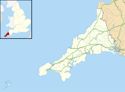
Location: Antony, Cornwall
Places / associated places: Antony, Cornwall
Location & Extent
GPS Location & Recorded Land Areas
Representative GPS point: 50.3857578, -4.2260195
Identity: confirmed — The supplied TNA/MDR record F292081, authority reference GB/NNAF/M317467, Antony location, and the associated 1691–1914 surveys, rentals, plans and maps identify the Antony manor in the parish of Antony, Cornwall. Historical sources identify this as the Antony/East Antony manor associated with the Carew family and Antony House. The term Churchtown distinguishes the manor record from other Antony names and refers to the parish's churchtown settlement, not a different county or parish.
Representative point: 50.3857578, -4.2260195
Basis: documented_manor_house — Antony House is the documented surviving manor house of the Antony/East Antony manor. The National Trust states that the Carew family held the manor from the fifteenth century and that the present Antony House was built as the family's principal house in the early eighteenth century. The listed landscape record identifies Antony House as the principal building of the historic Antony estate.
Point confidence: high
Boundary status: representative_point_only
Boundary period:
Boundary confidence: none
Boundary basis: The archival leads demonstrate that manor surveys and maps exist, including the 1783 Antony Manor Map, 1891 and 1914 maps, and surveys from 1691, 1698, 1762, 1770 and 1828. However, the accessible web evidence does not reproduce or provide a sufficiently legible georeferenced perimeter for the historical manorial land. The modern parish, Antony House registered landscape, and National Trust property area cannot safely be substituted for the manor boundary.
Sources:
- The National Archives, Antony Churchtown Manor record F292081: https://discovery.nationalarchives.gov.uk/details/c/F292081 — Registry record supplied for the exact manor, with authority reference GB/NNAF/M317467 and location Antony, Cornwall.
- National Trust, History of Antony: https://www.nationaltrust.org.uk/visit/cornwall/antony/history-of-antony — Identifies the manor of East Antony, its Carew ownership from the fifteenth century, the earlier manor-house site, and the present Antony House built in the early eighteenth century.
- Historic England, Antony registered park and garden, NHLE 1000647: https://historicengland.org.uk/listing/the-list/list-entry/1000647 — Identifies Antony House as the principal building of the historic Antony estate and records the believed site of the medieval Carew manor house east or north-east of the present house.
- National Trust Heritage Records, Site of Pound in Antony Park: https://heritagerecords.nationaltrust.org.uk/HBSMR/MonRecord.aspx?uid=MNA102460 — Records an eighteenth-century Antony Manor Map and a manor-related feature within Antony Park, corroborating the existence of a historic manor map and the association of the estate with the manor.
- Parks and Gardens, Antony, Cornwall: https://www.parksandgardens.org/places/antony — Provides the mapped location of Antony House at approximately 50.3857578, -4.2260195 and describes the historic East Antony manor and Carew estate.
- Historic England, Church of St James, Antony, NHLE 1140708: https://historicengland.org.uk/listing/the-list/list-entry/1140708 — Confirms the historic Antony churchtown location at NGR SX39833 54586 and its long-standing parish and Carew associations; useful contextual evidence but not a substitute for the manor-house point or manor boundary.
Warnings / uncertainty:
- The representative point is the surviving Antony House, not the approximate centre of the entire historical manor.
- The medieval manor-house site is separately reported by Historic England as approximately 530 metres north-east of the present house, but no sufficiently precise public coordinate for that lost site was found.
- No historical manor boundary polygon has been returned because the accessible sources establish the existence of manor maps and surveys without exposing a reliable perimeter.
About the Manor
A historic manor associated with Antony Churchtown in the parish of Antony, Cornwall.
Records & References
Sources and references mentioning this manor/title which are not necessarily conveyances or transfers.
24 records found · showing 9–16.
1783-1783: map, with other manors
Held by: Collection held privately: enquiries to Archives & Cornish Studies Service (formerly Cornwall RO)
1775-1775: plan
Held by: Collection held privately: enquiries to Archives & Cornish Studies Service (formerly Cornwall RO)
1772-1772: particular, with other manors
Held by: Collection held privately: enquiries to Archives & Cornish Studies Service (formerly Cornwall RO)
1771-1873: rentals, with other manors (70)
Held by: Collection held privately: enquiries to Archives & Cornish Studies Service (formerly Cornwall RO)
1770-1770: survey, with other manors
Held by: Collection held privately: enquiries to Archives & Cornish Studies Service (formerly Cornwall RO)
1769-1769: rental
Held by: Collection held privately: enquiries to Archives & Cornish Studies Service (formerly Cornwall RO)
1763-1763: rental, with other manors
Held by: Collection held privately: enquiries to Archives & Cornish Studies Service (formerly Cornwall RO)
1762-1762: survey, with other manors
Held by: Collection held privately: enquiries to Archives & Cornish Studies Service (formerly Cornwall RO)
Corrections / Challenges
Sign in to challenge or submit evidence against a recorded assertion.
JSON API
Machine-readable published manor data, including public images, mapped land areas, notes, rights, conveyances, relationships, records, source/document-library entries and public file links.
https://manorialregistry.com/index.php?rest_route=/mhr/v1/manor/antony-churchtown-manorPublic API access is currently disabled. Authorised API clients must use a private X-MHR-API-Key; currently only administrator keys are enabled.
Private source files, pending edits, moderation/admin information, user API keys and non-public import identifiers are not returned.