


Location: Kingswinford, Staffordshire
Places / associated places: Kingswinford, Staffordshire
Location & Extent
GPS Location & Recorded Land Areas
Representative GPS point: 52.46444, -2.13275
Identity: confirmed — The TNA/MDR record F256010 is explicitly titled Amblecote Manor and is associated with GB/NNAF/M274051. Independent historical evidence identifies Amblecote as the Staffordshire manor and settlement in the Kingswinford area, later held with the Enville estate. The record is not being conflated with another same-named manor.
Representative point: 52.46444, -2.13275
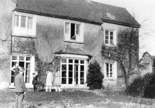
Basis: supported_manorial_centre — Low-confidence approximate point in the historic Amblecote manorial landscape, based on the documented Amblecote Hall/Amblecote Hall Farm area and the 1938 georeferenced aerial coverage of the associated estate and industrial landscape at SO910852. The manor house itself was demolished in the early 1950s and its precise site could not be securely recovered from the available sources.
Point confidence: low
Boundary status: representative_point_only
Boundary period: Medieval to early modern manor; later estate documentation extends into the 18th–20th centuries
Boundary confidence: none
Boundary basis: The sources establish the manor's location and identify associated open-field and estate lands, including Watery Fields and the Enville estate, but do not provide a sufficiently clear, source-backed perimeter for the historical manorial extent. The 689-acre figure associated with later Amblecote descriptions relates to the civil/ecclesiastical locality and cannot safely be substituted for the manor boundary.
Sources:
- The National Archives Discovery: Amblecote Manor, F256010: https://discovery.nationalarchives.gov.uk/details/c/F256010 — Primary registry record identifying the exact manor record as Amblecote Manor.
- Grey Family, Earls of Stamford and Warrington: records: https://www.nationalarchives.gov.uk/nra/lists/GB-2184-Grey.htm — National Archives report records a 15th-century manorial survey of Amblecote and extensive Amblecote estate, lease and deed material, confirming the manor's connection with the Enville estate.
- Memorial Archway at Stourbridge War Memorial Athletic Ground, Historic England: https://historicengland.org.uk/listing/the-list/list-entry/1439656 — States that the athletics-ground land was formerly an open field in the manor of Amblecote known as Watery Fields, providing direct historical geographic evidence for part of the manor's land.
- EPW057514: The John Hall and Co Ltd Amblecote Firebrick Works, Britain from Above: https://britainfromabove.org.uk/en/image/EPW057514 — Provides a georeferenced 1938 aerial view at SO910852 and identifies nearby Amblecote Hall and Amblecote Hall Farm, both later demolished; used only to support an approximate representative point, not a boundary.
- The History of Amblecote, Holy Trinity Amblecote: https://www.holytrinityamblecote.org.uk/amblecote.html — Summarizes the historical succession of the manor, including Stafford ownership and transfer to the Grey family of Enville in 1540.
- Amblecote, Open Domesday: https://opendomesday.org/place/SO8985/amblecote/ — Identifies Amblecote as the Domesday settlement and manor in Staffordshire, with its medieval location in the Kingswinford/Seisdon area.
Warnings / uncertainty:
- The manor house and hall farm were demolished, and the exact hall site is not securely documented in the accessible sources.
- No reliable historical manor boundary polygon was found; do not substitute the later Amblecote parish, urban-district, civil-parish or locality boundary.
- The representative coordinate is an approximate supported manorial-centre point and should not be treated as the exact former manor-house location.
About the Manor
Historic manor of Amblecote in Staffordshire, associated with the ancient parish of Oldswinford.
Corrections / Challenges
Sign in to challenge or submit evidence against a recorded assertion.
JSON API
Machine-readable published manor data, including public images, mapped land areas, notes, rights, conveyances, relationships, records, source/document-library entries and public file links.
https://manorialregistry.com/index.php?rest_route=/mhr/v1/manor/amblecote-manorPublic API access is currently disabled. Authorised API clients must use a private X-MHR-API-Key; currently only administrator keys are enabled.
Private source files, pending edits, moderation/admin information, user API keys and non-public import identifiers are not returned.