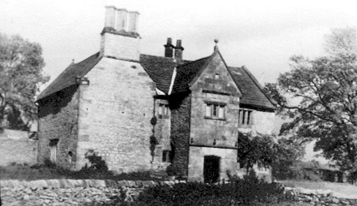



Location: Alstonfield, Staffordshire
Places / associated places: Alstonfield, Staffordshire
Location & Extent
GPS Location & Recorded Land Areas
Representative GPS point: 53.09646, -1.80405
Identity: confirmed — The TNA/MDR record F256008 and authority GB/NNAF/M274049 identify Alstonefield Manor at Alstonefield, Staffordshire. The Derbyshire Record Office catalogue independently identifies a continuous series of Alstonefield manorial court books, rolls, surveys, rentals and accounts, including records expressly covering Warslow and Longnor. Historic sources also identify Alstonefield Hall, formerly Hall Farmhouse, as the late-16th-century manor house of the Munday family.
Representative point: 53.09646, -1.80405
Basis: documented_manor_house — Alstonefield Hall, formerly Hall Farmhouse, Church Street, Alstonefield. Historic England records the building as formerly 'The Hall' and gives listing NGR SK 13222 55489; Staffordshire Historic Environment Record describes it as a late-16th-century farmhouse that originally served as the Munday family manor house.
Point confidence: high
Boundary status: representative_point_only
Boundary period: Medieval to early modern; the territorial composition varied over time
Boundary confidence: none
Boundary basis: The surviving evidence establishes a substantial territorial lordship associated with Alstonefield, including Alstonefield itself and, at different periods, the manorial or baronial jurisdictions of Warslow and Longnor, together with Quarnford and parts of the former Malbank or Alstonefield Forest around Fawfieldhead, Heathylee and Hollinsclough. The archive catalogue and historical sources do not provide a sufficiently clear, georeferenced perimeter for the manor as a whole. The 1839 Quarnford enclosure map documents only the enclosure area of that township and cannot safely be treated as the boundary of Alstonefield Manor. A parish or modern civil-parish polygon would be an inappropriate substitute.
Sources:
- The National Archives: Alstonefield Manor, TNA/MDR record F256008: https://discovery.nationalarchives.gov.uk/details/c/F256008 — Registry record identifying the exact manor as Alstonefield Manor at Alstonefield, Staffordshire, authority GB/NNAF/M274049.
- Derbyshire Record Office: Alstonefield manorial records: https://calmview.derbyshire.gov.uk/calmview/Overview.aspx?q=PlaceCode%3ANA1178&src=CalmView.Catalog — Catalogue groups the Alstonefield manor court books and rolls, including a court book of the manor of Alstonefield and the barony of Warslow and Longnor, and entries for Warslow.
- Historic England: Hall Farmhouse, Alstonefield, list entry 1374580: https://historicengland.org.uk/listing/the-list/list-entry/1374580 — Identifies Hall Farmhouse, formerly The Hall, gives listing NGR SK 13222 55489, and dates the building to 1587.
- Staffordshire County Council Historic Environment Record: Staffordshire Places: https://cdn.staffordshire.gov.uk/pasttrack/files/163/152/620.pdf — Describes Alstonefield Hall as a listed late-16th-century farmhouse that originally served as the Munday family manor house.
- Staffordshire Past Track: Alstonefield (Quarnford Township) enclosure map: https://www.search.staffspasttrack.org.uk/details.aspx?IO=1&PageIndex=1&ResourceID=47382&SearchType=2&ThemeID=780 — Authoritative record for the 1839 Quarnford enclosure map; useful evidence for a component area of the historical lordship but not a complete manor boundary.
- CRSBI: St Bartholomew, Longnor, Staffordshire: https://www.crsbi.ac.uk/view-item?key=WXsiUCI6eyJSZWdpb24iOnsibm93IjoiU3RhZmZvcmRzaGlyZSJ9fSwiRiI6ImV5SjBJanBiTmwxOSJ9&pg=8 — States that Longnor was part of Alstonefield manor by the 13th century, probably earlier, and remained so until the 16th century.
- T. Walter Hall, Sheffield and Its Environs, 13th to 17th Century: https://www.gutenberg.org/ebooks/37130.html.images — Discusses the territorial history of Alstonefield Manor and quotes a 1568 description of Hawkesyard in the High Frith as part and parcel of the manor, with defined local landmarks.
Warnings / uncertainty:
- The representative point is the documented manor-house site, not the geometric centre of the full historical manor.
- The historical extent was not necessarily coterminous with Alstonefield parish and changed through inheritance, partition, jurisdictional arrangements and later conveyances.
- No complete, reliable georeferenced polygon for the manor as a whole was located; do not inject a modern parish, civil-parish, postcode or conservation-area boundary.
Records & References
Sources and references mentioning this manor/title which are not necessarily conveyances or transfers.
54 records found · showing 1–8.
1829-1829: suit rolls
Held by: Derbyshire Record Office
1804-1804: court roll
Held by: Derbyshire Record Office
1767-1779: suit roll
Held by: Derbyshire Record Office
1767-1769: lists of inhabitants
Held by: Derbyshire Record Office
1702-1703: rental
Held by: Derbyshire Record Office
1697-1800: verdicts (2 bundles)
Held by: Derbyshire Record Office
1693-1694: rental
Held by: Derbyshire Record Office
1688-1689: rental
Held by: Derbyshire Record Office
Corrections / Challenges
Sign in to challenge or submit evidence against a recorded assertion.
JSON API
Machine-readable published manor data, including public images, mapped land areas, notes, rights, conveyances, relationships, records, source/document-library entries and public file links.
https://manorialregistry.com/index.php?rest_route=/mhr/v1/manor/alstonefield-manorPublic API access is currently disabled. Authorised API clients must use a private X-MHR-API-Key; currently only administrator keys are enabled.
Private source files, pending edits, moderation/admin information, user API keys and non-public import identifiers are not returned.