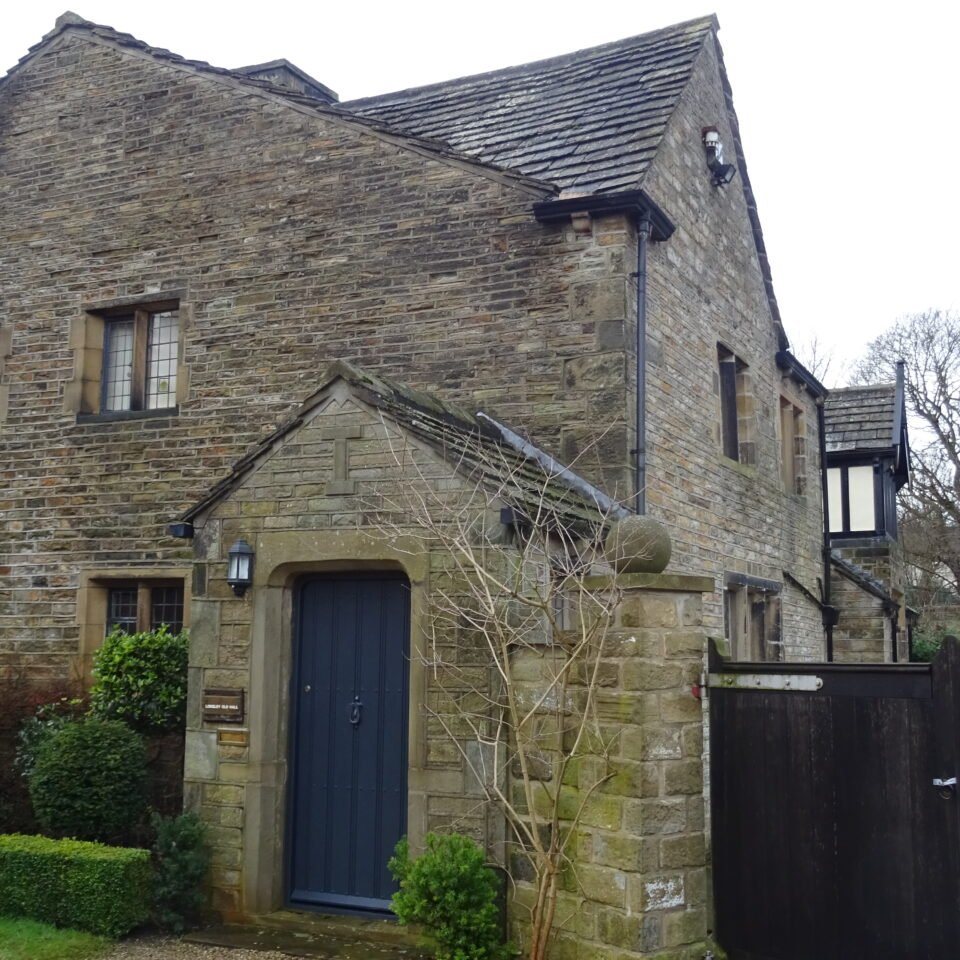



Historical names: Almanebyrig
Location: Almondbury, Yorkshire
Places / associated places: Almondbury, Yorkshire
Listed in Domesday Book: Yes
Location & Extent
GPS Location & Recorded Land Areas
Representative GPS point: 53.6227, -1.7712
Identity: confirmed — The supplied TNA/MDR record F243394, authority reference GB/NNAF/M170295, location Almondbury in Yorkshire, and the associated Duchy of Lancaster/Honour of Pontefract records consistently identify the Almondbury manor in the historic West Riding, not a same-named manor elsewhere. The 1341-1342 extent, 1425 rental, and especially the 1584 survey are directly associated with this manor.
Representative point: 53.6227, -1.7712
Basis: supported_manorial_centre — Castle Hill at Almondbury contains the medieval castle and associated settlement. Historic England research records identify the castle as potentially having functioned as an administrative centre for the manorial estate; the point is therefore a defensible manorial-centre proxy, although no surviving manor-house location has been securely established.
Point confidence: medium
Boundary status: representative_point_only
Boundary period: 1584, with earlier extent evidence from 1341-1342
Boundary confidence: none
Boundary basis: The 1584 survey is reported to delineate the manor's boundary and includes bounds, tenants, holdings, mills and commons. However, the accessible evidence does not reproduce the complete boundary itinerary, map, or parcel plan needed to construct a reliable ordered polygon. The six townships associated with Almondbury's court-leet jurisdiction—Almondbury, Huddersfield, Honley, Meltham, Quick/Saddleworth, Slaithwaite and South Crosland—must not be treated as the territorial boundary of the manor, since the evidence indicates a jurisdictional relationship over separate manors and townships rather than one continuous landholding.
Sources:
- Manorial Documents Register: Almondbury Manor, TNA record F243394: https://discovery.nationalarchives.gov.uk/details/c/F243394 — Registry record supplied for the exact manor; the page confirms the relevant TNA/MDR record identity, although its current web display requires JavaScript.
- Mandate to survey manor, 1584, Kaye Family Papers MS 240B:662: https://archives.lib.ku.edu/repositories/3/archival_objects/498153 — Describes a 1584 survey of the manor of Almondbury, parcel of the Duchy of Lancaster, at Almondbury in the West Riding.
- Yorkshire Archaeological Society Collections Guide: https://www.yas.org.uk/Portals/0/Collections%20Guide%2010Feb2018.pdf — Identifies MS205 as containing a copy of the 1584 inquisition regarding the manor and lordship of Almondbury, together with copies of the 1343 extent and 1425 rental.
- Manor Court Rolls from the West Riding, Chetham's Library: https://library.chethams.com/blog/manor-court-rolls-from-the-west-riding/ — Explains the Almondbury court network involving Almondbury, Huddersfield, Honley, Meltham, Saddleworth/Quick, Slaithwaite and South Crosland, while distinguishing those townships' separate manors from Almondbury's jurisdiction.
- The Wapentake Courts of The Honour of Pontefract, 1427-1877: https://www.tandfonline.com/doi/abs/10.1080/0078172X.2020.1712547 — States that Almondbury manor held tourns attended by Almondbury township and the townships of Huddersfield, Quick/Saddleworth, Slaithwaite, South Crosland, Honley and Meltham; this supports the jurisdictional distinction used in the boundary assessment.
- Historic England Research Record: Castle Hill, Almondbury: https://www.heritagegateway.org.uk/Gateway/Results_Single.aspx?resourceID=19191&uid=1032947 — Records the medieval castle at Castle Hill and notes that it may have served as an administrative centre for the manorial estate.
- Atlas of Hillforts of Britain and Ireland: Castle Hill, Almondbury: https://hillforts.arch.ox.ac.uk/records/EN1616.html — Provides the WGS84 location used for the representative point: latitude 53.62270038826175, longitude -1.7711992850035134.
Warnings / uncertainty:
- No complete historically evidenced polygon was found in the accessible online material.
- The 1584 survey and 1341-1342 extent remain the best leads for reconstructing the territorial extent, but the relevant archival manuscripts or published transcription would need to be consulted directly.
- The six-township Almondbury court-leet network is not equivalent to the continuous territorial extent of Almondbury Manor.
- The representative point marks a supported medieval manorial/administrative centre rather than a surviving documented manor house.
About the Manor
A historic manor at Almondbury in the ancient parish of Almondbury, Yorkshire.
Ownership / Holder Account
In Domesday Book (1086), Almondbury is recorded among the lands of Ilbert de Lacy.
Records & References
Sources and references mentioning this manor/title which are not necessarily conveyances or transfers.
104 records found · showing 9–16.
1867-1869: deeds and awards of enfranchisement of copyhold land (2)
Held by: The National Archives
1857-1858: warrant to summon jury
Held by: West Yorkshire Archive Service, Kirklees
Further information: NRA 7344 Ramsden
1857: complaint against by-lawmen and pinder
Held by: West Yorkshire Archive Service, Kirklees
Further information: NRA 7344 Ramsden
1857: letter to gentlemen of court
Held by: West Yorkshire Archive Service, Kirklees
Further information: NRA 7344 Ramsden
1856: presentments (draft)
Held by: West Yorkshire Archive Service, Kirklees
Further information: NRA 7344 Ramsden
1855-1857: court roll (draft)
Held by: West Yorkshire Archive Service, Kirklees
Further information: NRA 7344 Ramsden
1854: suit roll
Held by: West Yorkshire Archive Service, Kirklees
Further information: NRA 7344 Ramsden
1840-1900: file of evidence rel to enfranchisement of copyhold land
Held by: The National Archives
Corrections / Challenges
Sign in to challenge or submit evidence against a recorded assertion.
JSON API
Machine-readable published manor data, including public images, mapped land areas, notes, rights, conveyances, relationships, records, source/document-library entries and public file links.
https://manorialregistry.com/index.php?rest_route=/mhr/v1/manor/almondbury-manorPublic API access is currently disabled. Authorised API clients must use a private X-MHR-API-Key; currently only administrator keys are enabled.
Private source files, pending edits, moderation/admin information, user API keys and non-public import identifiers are not returned.