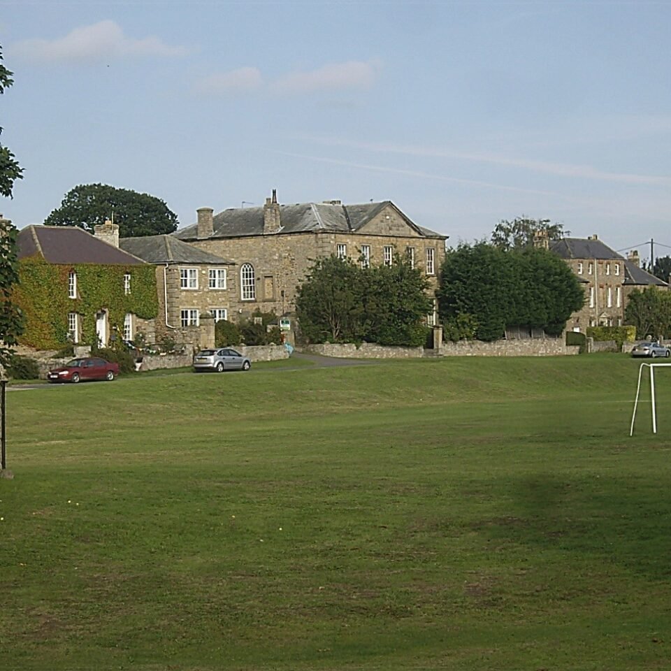



Location: Stanwick St John, Yorkshire
Places / associated places: Stanwick St John, Yorkshire
Location & Extent
GPS Location & Recorded Land Areas
Representative GPS point: 54.4972, -1.6859
Identity: confirmed — The registry location and associated place, Stanwick St John, distinguish this record from the separate Aldborough/Aldbrough manor near Boroughbridge and from Aldbrough in the East Riding. Historical sources identify Aldbrough St John as a manor and record medieval and early-modern manorial administration there, including ministers' accounts and court material consistent with the supplied TNA/MDR leads.
Representative point: 54.4972, -1.6859
Basis: documented_manor_house — Old Hall, Aldbrough St John, is a surviving historic hall associated in local historical accounts with the manor and the Catterick family. The listed-building record locates the building at NZ204113. The earlier medieval manor-house site described by Leland was in the Aldbrough valley beside the beck; the precise medieval building footprint is not securely identified.
Point confidence: medium
Boundary status: representative_point_only
Boundary period: Medieval to early modern; later manorial extent evidenced in the nineteenth century
Boundary confidence: none
Boundary basis: Available sources establish the manor's location and provide quantitative indications of its territorial scale, but do not supply a sufficiently clear manor boundary. A 1436-1438/late-medieval inquisition describes Aldbrough manor with 32 bovates of customary land, 10 cottages, free-tenement rents, a watermill, common oven, forges and court profits. A 1840 description states that Aldbrough township contained nearly 2,000 acres, mostly owned by the lord of the manor, and the 1848 tithe project provides a mapped township/parish-land framework. These sources do not demonstrate that the full township or parish equalled the historical manor, so no polygon is returned.
Sources:
- The National Archives: Aldbrough Manor record F242250: https://discovery.nationalarchives.gov.uk/details/c/F242250 — Registry authority record identifying the manor record and its associated archival material.
- The National Archives: Ministers' accounts, 1436-1438, including Aldbrough: https://discovery.nationalarchives.gov.uk/details/r/N14327884 — Supplied archival lead for medieval manorial accounts.
- Mapping the Medieval Countryside: Inquisition mentioning Aldbrough manor: https://ipm-os.kdl.kcl.ac.uk/view/inquisition/24-520/526.html — Describes Aldbrough as a manor held of the king in chief and records its cottages, bovates, rents, watermill and court profits.
- Aldbrough St John, The Gatehouse Gazetteer: https://www.gatehouse-gazetteer.info/English%20sites/2028.html — Identifies Aldbrough St John as a probable fortified manor-house site and records Leland's description of substantial ruins beside the beck.
- Old Hall Cottage, Old Hall and Old Hall Cottage East, Aldbrough St John: https://britishlistedbuildings.co.uk/101131952-old-hall-cottage-old-hall-and-old-hall-cottage-east-aldbrough — Provides the surviving Old Hall's coordinates, 54.4972, -1.6859, and identifies it as an early-to-mid eighteenth-century hall at Aldbrough Low Green.
- Aldbrough Tithe Maps Project: https://northyorkstithes.com/project/aldbrough/ — Identifies Aldbrough in the parish of Stanwick St John, gives the 1840 description of nearly 2,000 acres and predominant ownership by the lord of the manor, and records the 1848 tithe map and apportionment.
- Stanwick Hall, England's Lost Country Houses: https://lostheritage.org.uk/houses/lh_yorkshire_stanwickhall.html — Provides local estate and manorial context linking the Catterick and Smithson/Percy estates with Stanwick and Aldbrough St John.
Warnings / uncertainty:
- The representative point is defensible as the location of the surviving historic hall/manorial centre, but it should not be treated as the exact footprint of the medieval manor house.
- No historically documented perimeter or parcel-based reconstruction sufficient for a safe polygon was located.
- Do not substitute the modern civil parish or the entire nineteenth-century township for the medieval manorial extent.
- The supplied court-roll and ministers' account references are consistent with Aldbrough St John, not the separate Aldborough near Boroughbridge or the East Riding Aldbrough.
About the Manor
A manor associated with Aldbrough in the parish of Stanwick St John, Yorkshire.
Records & References
Sources and references mentioning this manor/title which are not necessarily conveyances or transfers.
8 records found · showing 1–8.
1508-1526: ministers' accounts, with other manors (15)
Held by: The National Archives
1506-1508: ministers' accounts, with other manors
Held by: The National Archives
1493-1497: ministers' accounts, with other manors (3)
Held by: The National Archives
1488-1492: ministers' accounts, with other manors (3)
Held by: The National Archives
1473-1475: ministers' accounts, with other manors
Held by: The National Archives
1465-1467: ministers' accounts, with other manors
Held by: The National Archives
1441: court roll
Held by: British Library, Manuscript Collections
1436-1438: ministers' accounts, with other manors
Held by: The National Archives
Corrections / Challenges
Sign in to challenge or submit evidence against a recorded assertion.
JSON API
Machine-readable published manor data, including public images, mapped land areas, notes, rights, conveyances, relationships, records, source/document-library entries and public file links.
https://manorialregistry.com/index.php?rest_route=/mhr/v1/manor/aldbrough-manorPublic API access is currently disabled. Authorised API clients must use a private X-MHR-API-Key; currently only administrator keys are enabled.
Private source files, pending edits, moderation/admin information, user API keys and non-public import identifiers are not returned.