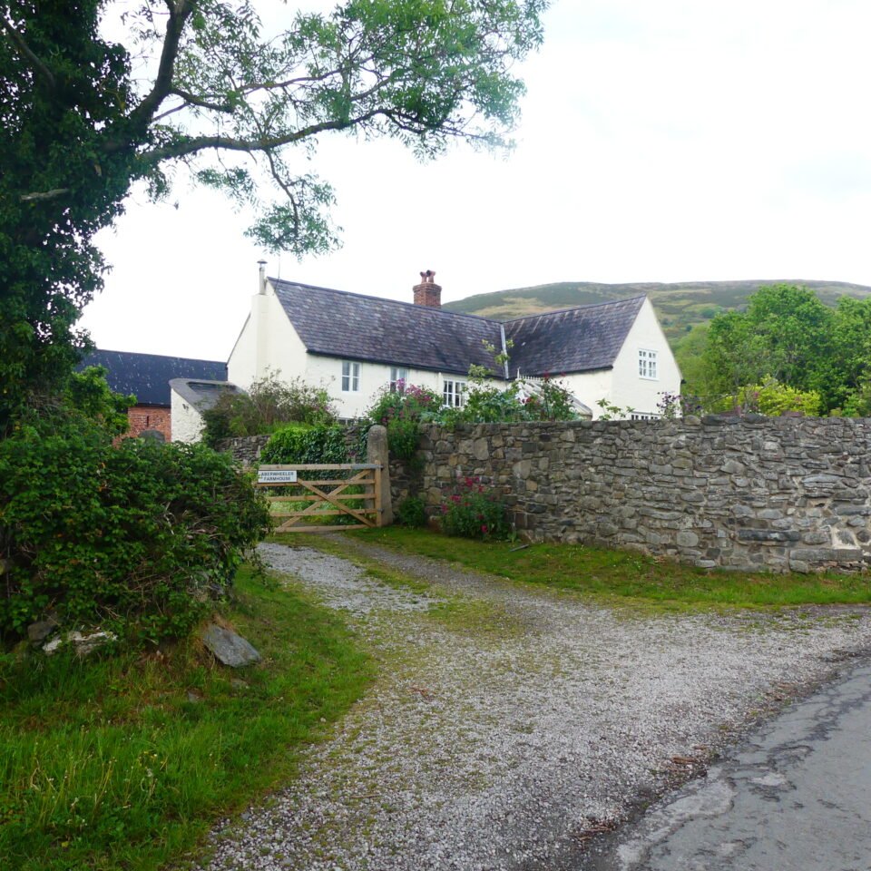



Location: Denbighshire
Places / associated places: Denbighshire | Flintshire
Location & Extent
GPS Location & Recorded Land Areas
Representative GPS point: 53.2191, -3.3501
Identity: confirmed — The registry name corresponds to the historic Aberchwiler/Aberwheeler township and manor in the ancient parish of Bodfari, Denbighshire. Historical spellings include Aberquilar, Ab’rchwilari, Aberchwiler, Aberquiller and Aberquiler. The historic territory lay in the Denbighshire–Flintshire borderland and was associated with the lordship of Dyffryn Clwyd/Ruthin.
Representative point: 53.2191, -3.3501
Basis: settlement_proxy — Representative point for the historic Aberwheeler/Aberchwiler settlement, using the documented Aberwheeler House location within the settlement area. No surviving source located in this research securely identifies Aberwheeler House as the medieval manor house.
Point confidence: low
Boundary status: representative_point_only
Boundary period: Medieval to early modern; boundary evidence especially documented in a 1737 perambulation of the lordship of Ruthin/Dyffryn Clwyd
Boundary confidence: medium
Boundary basis: The 1737 perambulation identifies the township of Aberchwiler as part of the lordship and describes boundary features along the Afon Chwiler, the Glyn dingle, Rhos Goch, Yr Orseddau, Tavarn y Grisiolen, Nant Mihangel, Maesmynan, Moel y Parc and the mountain ridge toward Moel Arthur. It also explicitly records sections where Aberchwiler adjoined land in Flintshire. However, the surviving evidence located here describes only segments within the wider lordship boundary and does not provide a complete, georeferenced perimeter for Aberchwiler Manor itself. The parish, community or modern county boundary has therefore not been substituted for the manorial boundary.
Sources:
- The National Archives, Manorial Documents Register: Aberchwiler Manor, F237265: https://discovery.nationalarchives.gov.uk/details/c/F237265 — Registry record supplied for the exact manor identity and authority reference GB/NNAF/M171601.
- Historic Place Names of Wales: Aberwheeler / Aberchwiler: https://historicplacenames.rcahmw.gov.uk/placenames?hpn=6&hps=10&hs=1&pn=658&ps=10&q=ber&s=1&tab=headnames — Identifies Aberwheeler/Aberchwiler as the historic place-name at grid reference SJ 09600 69200 in Aberwheeler Rural, Denbighshire.
- History of Maes Mynan: The Manor of Maes Mynan and the Grey Lords of Ruthin: https://acornleisure.com/wp-content/uploads/2022/08/History-of-MAES-MYNAN-REPORT.pdf — Discusses Aberchwiler/Aberquiller in the medieval and early-modern territorial context, identifies the township of Aberchwiler within the lordship of Dyffryn Clwyd, and reproduces the 1737 textual perambulation describing its boundary relationships with Flintshire.
- Welsh Language Commissioner: Aberchwiler: https://www.welshlanguagecommissioner.wales/standard-welsh-place-names/aberchwiler — Confirms Aberchwiler as the standard Welsh name, Aberwheeler as the English form, and locates it in Denbighshire at grid reference SJ0969.
- Aberwheeler House, Aberwheeler, Denbighshire: https://britishlistedbuildings.co.uk/300000720-aberwheeler-house-aberwheeler — Provides a precise WGS84 location within the historic Aberwheeler settlement and documents the surviving early house, while describing it as a later farmhouse rather than securely identifying it as the manor house.
Warnings / uncertainty:
- No complete historical manor map, survey, or georeferenced perimeter for Aberchwiler Manor was located.
- The 1737 boundary text concerns the wider lordship of Ruthin/Dyffryn Clwyd and only partially describes the Aberchwiler section; it cannot safely be converted into a complete manor polygon without further archival mapping.
- The representative coordinate is a low-confidence settlement proxy, not a confirmed manor-house location.
Corrections / Challenges
Sign in to challenge or submit evidence against a recorded assertion.
JSON API
Machine-readable published manor data, including public images, mapped land areas, notes, rights, conveyances, relationships, records, source/document-library entries and public file links.
https://manorialregistry.com/index.php?rest_route=/mhr/v1/manor/aberchwiler-manorPublic API access is currently disabled. Authorised API clients must use a private X-MHR-API-Key; currently only administrator keys are enabled.
Private source files, pending edits, moderation/admin information, user API keys and non-public import identifiers are not returned.